You are here: Home > Network List > TA - USArray Transportable Network (new EarthScope stations) Stations List
> Station B18K Kokolik River, AK, USA > Earthquake Result Viewer
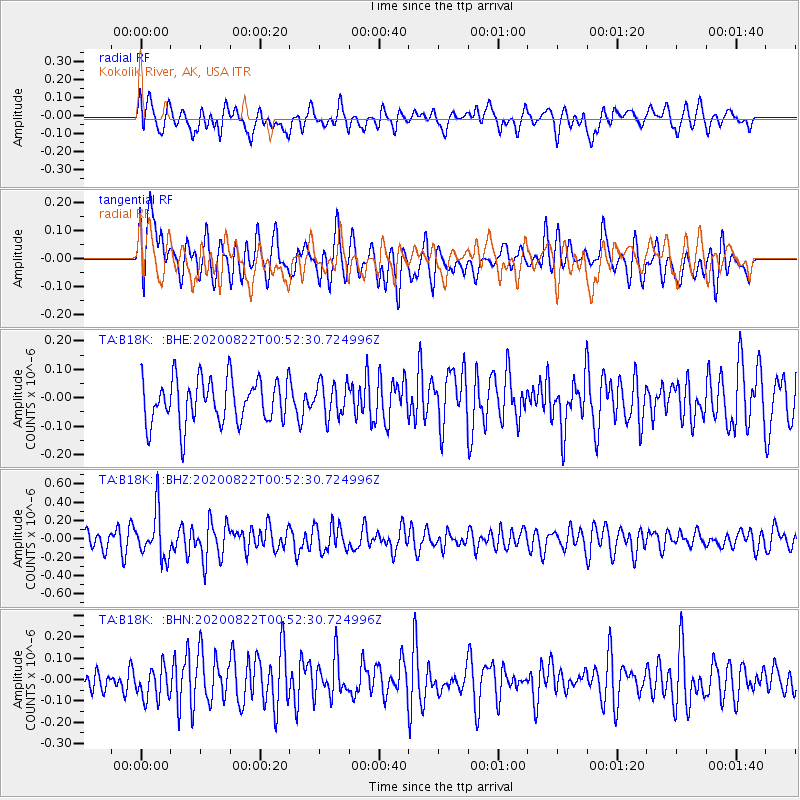
B18K Kokolik River, AK, USA - Earthquake Result Viewer
*The percent match for this event was below the threshold and hence no stack was calculated.
| Earthquake location: |
Southwest Of Sumatra, Indonesia |
| Earthquake latitude/longitude: |
-4.1/101.0 |
| Earthquake time(UTC): |
2020/08/22 (235) 00:39:33 GMT |
| Earthquake Depth: |
10 km |
| Earthquake Magnitude: |
5.4 Mww |
| Earthquake Catalog/Contributor: |
NEIC PDE/us |
|
| Network: |
TA USArray Transportable Network (new EarthScope stations) |
| Station: |
B18K Kokolik River, AK, USA |
| Lat/Lon: |
69.36 N/161.80 W |
| Elevation: |
222 m |
|
| Distance: |
96.3 deg |
| Az: |
20.724 deg |
| Baz: |
275.307 deg |
| Ray Param: |
$rayparam |
*The percent match for this event was below the threshold and hence was not used in the summary stack. |
|
| Radial Match: |
59.37422 % |
| Radial Bump: |
400 |
| Transverse Match: |
54.79123 % |
| Transverse Bump: |
400 |
| SOD ConfigId: |
21709731 |
| Insert Time: |
2020-09-05 00:45:21.698 +0000 |
| GWidth: |
2.5 |
| Max Bumps: |
400 |
| Tol: |
0.001 |
|
Signal To Noise
| Channel | StoN | STA | LTA |
| TA:B18K: :BHZ:20200822T00:52:30.724996Z | 2.3981404 | 2.5291754E-7 | 1.0546403E-7 |
| TA:B18K: :BHN:20200822T00:52:30.724996Z | 1.184935 | 7.349673E-8 | 6.202596E-8 |
| TA:B18K: :BHE:20200822T00:52:30.724996Z | 0.76876956 | 5.994714E-8 | 7.797804E-8 |
| Arrivals |
| Ps | |
| PpPs | |
| PsPs/PpSs | |


