You are here: Home > Network List > TA - USArray Transportable Network (new EarthScope stations) Stations List
> Station C16K Lisburne Hills, AK, USA > Earthquake Result Viewer
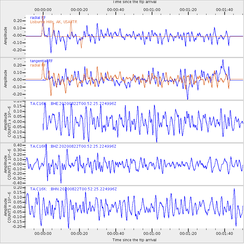
C16K Lisburne Hills, AK, USA - Earthquake Result Viewer
*The percent match for this event was below the threshold and hence no stack was calculated.
| Earthquake location: |
Southwest Of Sumatra, Indonesia |
| Earthquake latitude/longitude: |
-4.1/101.0 |
| Earthquake time(UTC): |
2020/08/22 (235) 00:39:33 GMT |
| Earthquake Depth: |
10 km |
| Earthquake Magnitude: |
5.4 Mww |
| Earthquake Catalog/Contributor: |
NEIC PDE/us |
|
| Network: |
TA USArray Transportable Network (new EarthScope stations) |
| Station: |
C16K Lisburne Hills, AK, USA |
| Lat/Lon: |
68.27 N/165.34 W |
| Elevation: |
102 m |
|
| Distance: |
95.1 deg |
| Az: |
21.903 deg |
| Baz: |
271.89 deg |
| Ray Param: |
$rayparam |
*The percent match for this event was below the threshold and hence was not used in the summary stack. |
|
| Radial Match: |
47.618683 % |
| Radial Bump: |
400 |
| Transverse Match: |
51.029655 % |
| Transverse Bump: |
400 |
| SOD ConfigId: |
21709731 |
| Insert Time: |
2020-09-05 00:45:24.371 +0000 |
| GWidth: |
2.5 |
| Max Bumps: |
400 |
| Tol: |
0.001 |
|
Signal To Noise
| Channel | StoN | STA | LTA |
| TA:C16K: :BHZ:20200822T00:52:25.224996Z | 2.0634632 | 1.6909398E-7 | 8.194669E-8 |
| TA:C16K: :BHN:20200822T00:52:25.224996Z | 0.9380759 | 6.918853E-8 | 7.3755785E-8 |
| TA:C16K: :BHE:20200822T00:52:25.224996Z | 0.8679179 | 6.9895734E-8 | 8.053266E-8 |
| Arrivals |
| Ps | |
| PpPs | |
| PsPs/PpSs | |


