You are here: Home > Network List > TA - USArray Transportable Network (new EarthScope stations) Stations List
> Station TUL3 Leonard, OK, USA > Earthquake Result Viewer
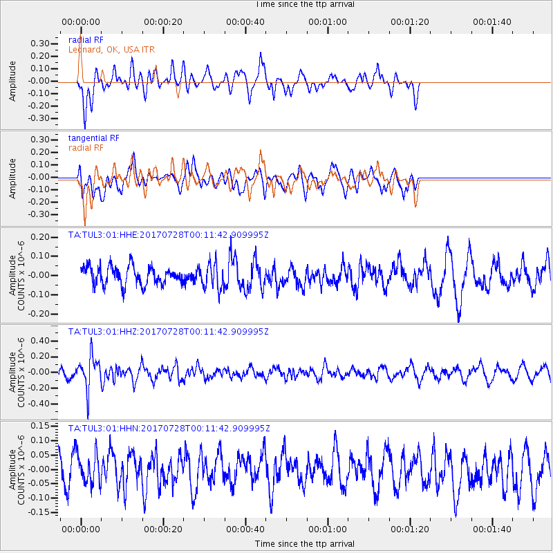
TUL3 Leonard, OK, USA - Earthquake Result Viewer
*The percent match for this event was below the threshold and hence no stack was calculated.
| Earthquake location: |
Southeast Of Honshu, Japan |
| Earthquake latitude/longitude: |
29.3/143.0 |
| Earthquake time(UTC): |
2017/07/27 (208) 23:58:52 GMT |
| Earthquake Depth: |
10 km |
| Earthquake Magnitude: |
5.3 Mww |
| Earthquake Catalog/Contributor: |
NEIC PDE/us |
|
| Network: |
TA USArray Transportable Network (new EarthScope stations) |
| Station: |
TUL3 Leonard, OK, USA |
| Lat/Lon: |
35.91 N/95.79 W |
| Elevation: |
265 m |
|
| Distance: |
94.8 deg |
| Az: |
44.143 deg |
| Baz: |
311.452 deg |
| Ray Param: |
$rayparam |
*The percent match for this event was below the threshold and hence was not used in the summary stack. |
|
| Radial Match: |
57.415512 % |
| Radial Bump: |
400 |
| Transverse Match: |
43.25906 % |
| Transverse Bump: |
400 |
| SOD ConfigId: |
2140511 |
| Insert Time: |
2017-08-10 15:59:46.508 +0000 |
| GWidth: |
2.5 |
| Max Bumps: |
400 |
| Tol: |
0.001 |
|
Signal To Noise
| Channel | StoN | STA | LTA |
| TA:TUL3:01:HHZ:20170728T00:11:42.909995Z | 3.0666783 | 2.1027351E-7 | 6.856719E-8 |
| TA:TUL3:01:HHN:20170728T00:11:42.909995Z | 1.0778474 | 5.2434416E-8 | 4.8647347E-8 |
| TA:TUL3:01:HHE:20170728T00:11:42.909995Z | 1.3712509 | 6.478339E-8 | 4.724401E-8 |
| Arrivals |
| Ps | |
| PpPs | |
| PsPs/PpSs | |


