You are here: Home > Network List > CN - Canadian National Seismograph Network Stations List
> Station INK INUVIK, NT > Earthquake Result Viewer
INK INUVIK, NT - Earthquake Result Viewer
*The percent match for this event was below the threshold and hence no stack was calculated.
| Earthquake location: |
New Britain Region, P.N.G. |
| Earthquake latitude/longitude: |
-4.8/152.7 |
| Earthquake time(UTC): |
2020/08/23 (236) 16:46:47 GMT |
| Earthquake Depth: |
50 km |
| Earthquake Magnitude: |
5.5 Mww |
| Earthquake Catalog/Contributor: |
NEIC PDE/us |
|
| Network: |
CN Canadian National Seismograph Network |
| Station: |
INK INUVIK, NT |
| Lat/Lon: |
68.31 N/133.53 W |
| Elevation: |
44 m |
|
| Distance: |
88.5 deg |
| Az: |
20.924 deg |
| Baz: |
253.19 deg |
| Ray Param: |
$rayparam |
*The percent match for this event was below the threshold and hence was not used in the summary stack. |
|
| Radial Match: |
57.294083 % |
| Radial Bump: |
400 |
| Transverse Match: |
61.7244 % |
| Transverse Bump: |
400 |
| SOD ConfigId: |
21709731 |
| Insert Time: |
2020-09-06 16:55:23.661 +0000 |
| GWidth: |
2.5 |
| Max Bumps: |
400 |
| Tol: |
0.001 |
|
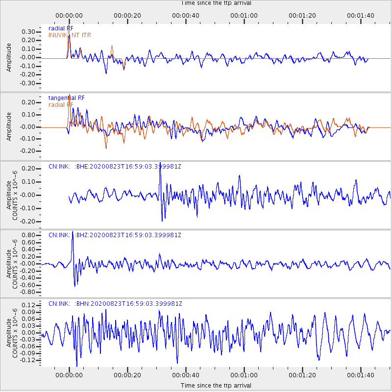
Signal To Noise
| Channel | StoN | STA | LTA |
| CN:INK: :BHZ:20200823T16:59:03.399981Z | 6.880435 | 3.2893794E-7 | 4.7807724E-8 |
| CN:INK: :BHN:20200823T16:59:03.399981Z | 2.0535157 | 5.42236E-8 | 2.6405251E-8 |
| CN:INK: :BHE:20200823T16:59:03.399981Z | 3.2536006 | 8.82984E-8 | 2.7138674E-8 |
| Arrivals |
| Ps | |
| PpPs | |
| PsPs/PpSs | |


