You are here: Home > Network List > TA - USArray Transportable Network (new EarthScope stations) Stations List
> Station H16K Elim, AK, USA > Earthquake Result Viewer
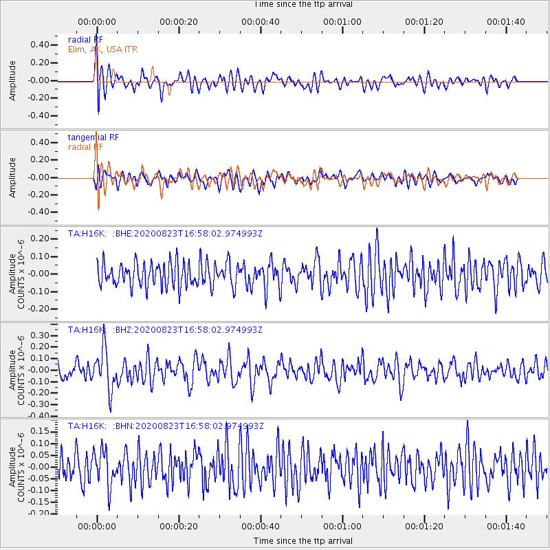
H16K Elim, AK, USA - Earthquake Result Viewer
*The percent match for this event was below the threshold and hence no stack was calculated.
| Earthquake location: |
New Britain Region, P.N.G. |
| Earthquake latitude/longitude: |
-4.8/152.7 |
| Earthquake time(UTC): |
2020/08/23 (236) 16:46:47 GMT |
| Earthquake Depth: |
50 km |
| Earthquake Magnitude: |
5.5 Mww |
| Earthquake Catalog/Contributor: |
NEIC PDE/us |
|
| Network: |
TA USArray Transportable Network (new EarthScope stations) |
| Station: |
H16K Elim, AK, USA |
| Lat/Lon: |
64.64 N/162.24 W |
| Elevation: |
216 m |
|
| Distance: |
76.8 deg |
| Az: |
18.252 deg |
| Baz: |
226.446 deg |
| Ray Param: |
$rayparam |
*The percent match for this event was below the threshold and hence was not used in the summary stack. |
|
| Radial Match: |
55.935406 % |
| Radial Bump: |
400 |
| Transverse Match: |
46.45252 % |
| Transverse Bump: |
400 |
| SOD ConfigId: |
21709731 |
| Insert Time: |
2020-09-06 17:01:12.196 +0000 |
| GWidth: |
2.5 |
| Max Bumps: |
400 |
| Tol: |
0.001 |
|
Signal To Noise
| Channel | StoN | STA | LTA |
| TA:H16K: :BHZ:20200823T16:58:02.974993Z | 2.9268928 | 1.8007393E-7 | 6.152392E-8 |
| TA:H16K: :BHN:20200823T16:58:02.974993Z | 1.1136148 | 7.567434E-8 | 6.795379E-8 |
| TA:H16K: :BHE:20200823T16:58:02.974993Z | 1.0198617 | 6.590722E-8 | 6.4623684E-8 |
| Arrivals |
| Ps | |
| PpPs | |
| PsPs/PpSs | |


