You are here: Home > Network List > TA - USArray Transportable Network (new EarthScope stations) Stations List
> Station H31M Peel River, Yukon, CAN > Earthquake Result Viewer
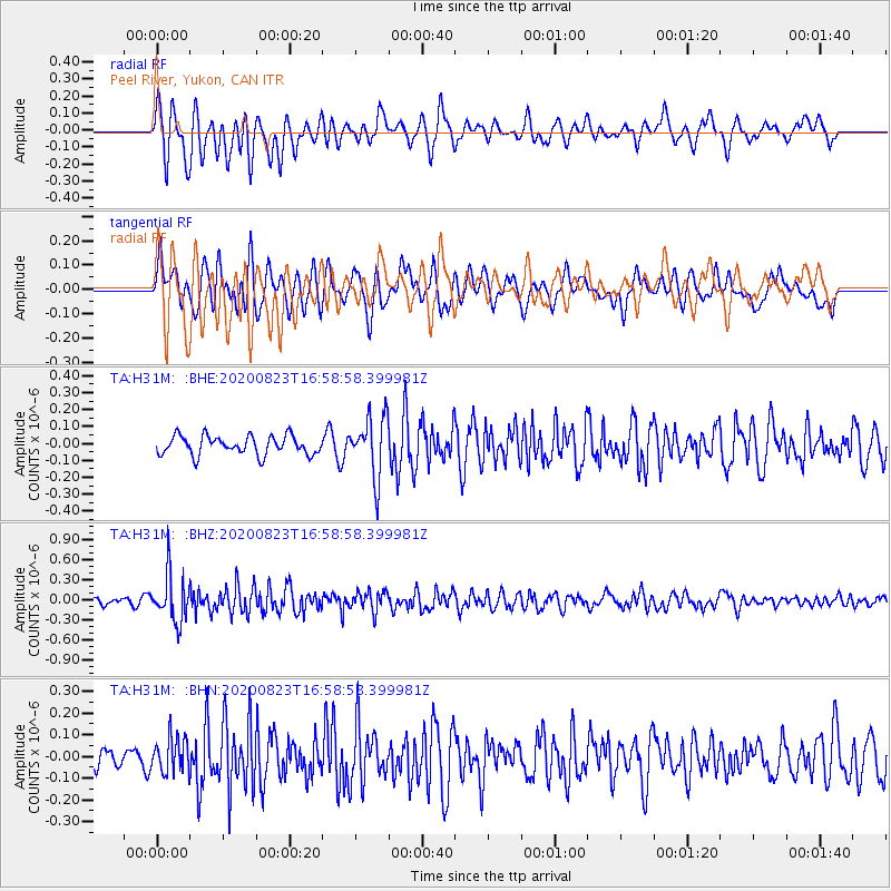
H31M Peel River, Yukon, CAN - Earthquake Result Viewer
*The percent match for this event was below the threshold and hence no stack was calculated.
| Earthquake location: |
New Britain Region, P.N.G. |
| Earthquake latitude/longitude: |
-4.8/152.7 |
| Earthquake time(UTC): |
2020/08/23 (236) 16:46:47 GMT |
| Earthquake Depth: |
50 km |
| Earthquake Magnitude: |
5.5 Mww |
| Earthquake Catalog/Contributor: |
NEIC PDE/us |
|
| Network: |
TA USArray Transportable Network (new EarthScope stations) |
| Station: |
H31M Peel River, Yukon, CAN |
| Lat/Lon: |
65.81 N/134.34 W |
| Elevation: |
642 m |
|
| Distance: |
87.4 deg |
| Az: |
23.232 deg |
| Baz: |
252.521 deg |
| Ray Param: |
$rayparam |
*The percent match for this event was below the threshold and hence was not used in the summary stack. |
|
| Radial Match: |
70.50704 % |
| Radial Bump: |
400 |
| Transverse Match: |
67.558556 % |
| Transverse Bump: |
400 |
| SOD ConfigId: |
21709731 |
| Insert Time: |
2020-09-06 17:01:21.566 +0000 |
| GWidth: |
2.5 |
| Max Bumps: |
400 |
| Tol: |
0.001 |
|
Signal To Noise
| Channel | StoN | STA | LTA |
| TA:H31M: :BHZ:20200823T16:58:58.399981Z | 5.416739 | 3.5466272E-7 | 6.547533E-8 |
| TA:H31M: :BHN:20200823T16:58:58.399981Z | 1.7673659 | 8.177614E-8 | 4.627007E-8 |
| TA:H31M: :BHE:20200823T16:58:58.399981Z | 3.2091608 | 1.7812874E-7 | 5.5506334E-8 |
| Arrivals |
| Ps | |
| PpPs | |
| PsPs/PpSs | |


