You are here: Home > Network List > CI - Caltech Regional Seismic Network Stations List
> Station MPM Manuel Prospect Mine, California, USA > Earthquake Result Viewer
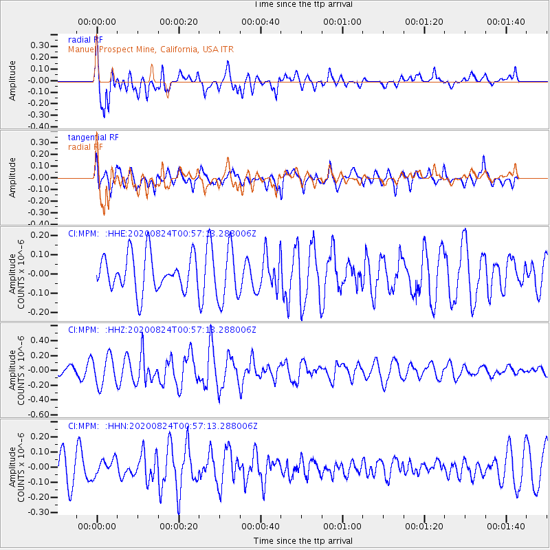
MPM Manuel Prospect Mine, California, USA - Earthquake Result Viewer
*The percent match for this event was below the threshold and hence no stack was calculated.
| Earthquake location: |
Kermadec Islands Region |
| Earthquake latitude/longitude: |
-28.9/-176.3 |
| Earthquake time(UTC): |
2020/08/24 (237) 00:45:08 GMT |
| Earthquake Depth: |
10 km |
| Earthquake Magnitude: |
5.4 Mww |
| Earthquake Catalog/Contributor: |
NEIC PDE/us |
|
| Network: |
CI Caltech Regional Seismic Network |
| Station: |
MPM Manuel Prospect Mine, California, USA |
| Lat/Lon: |
36.06 N/117.49 W |
| Elevation: |
185 m |
|
| Distance: |
85.1 deg |
| Az: |
44.08 deg |
| Baz: |
228.822 deg |
| Ray Param: |
$rayparam |
*The percent match for this event was below the threshold and hence was not used in the summary stack. |
|
| Radial Match: |
67.31632 % |
| Radial Bump: |
400 |
| Transverse Match: |
54.174084 % |
| Transverse Bump: |
400 |
| SOD ConfigId: |
21709731 |
| Insert Time: |
2020-09-07 00:51:09.107 +0000 |
| GWidth: |
2.5 |
| Max Bumps: |
400 |
| Tol: |
0.001 |
|
Signal To Noise
| Channel | StoN | STA | LTA |
| CI:MPM: :HHZ:20200824T00:57:13.288006Z | 1.902231 | 1.9707437E-7 | 1.0360171E-7 |
| CI:MPM: :HHN:20200824T00:57:13.288006Z | 0.387869 | 5.401282E-8 | 1.3925532E-7 |
| CI:MPM: :HHE:20200824T00:57:13.288006Z | 1.5259938 | 1.4163604E-7 | 9.2815604E-8 |
| Arrivals |
| Ps | |
| PpPs | |
| PsPs/PpSs | |


