You are here: Home > Network List > CI - Caltech Regional Seismic Network Stations List
> Station MPM Manuel Prospect Mine, California, USA > Earthquake Result Viewer
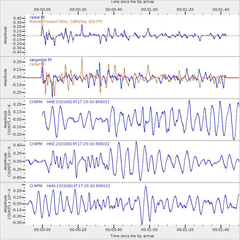
MPM Manuel Prospect Mine, California, USA - Earthquake Result Viewer
*The percent match for this event was below the threshold and hence no stack was calculated.
| Earthquake location: |
Tonga Islands |
| Earthquake latitude/longitude: |
-15.4/-174.2 |
| Earthquake time(UTC): |
2020/08/24 (237) 17:14:55 GMT |
| Earthquake Depth: |
8.3 km |
| Earthquake Magnitude: |
5.6 Mww |
| Earthquake Catalog/Contributor: |
NEIC PDE/us |
|
| Network: |
CI Caltech Regional Seismic Network |
| Station: |
MPM Manuel Prospect Mine, California, USA |
| Lat/Lon: |
36.06 N/117.49 W |
| Elevation: |
185 m |
|
| Distance: |
74.1 deg |
| Az: |
44.786 deg |
| Baz: |
237.005 deg |
| Ray Param: |
$rayparam |
*The percent match for this event was below the threshold and hence was not used in the summary stack. |
|
| Radial Match: |
64.80796 % |
| Radial Bump: |
400 |
| Transverse Match: |
61.990623 % |
| Transverse Bump: |
400 |
| SOD ConfigId: |
21709731 |
| Insert Time: |
2020-09-07 17:22:24.489 +0000 |
| GWidth: |
2.5 |
| Max Bumps: |
400 |
| Tol: |
0.001 |
|
Signal To Noise
| Channel | StoN | STA | LTA |
| CI:MPM: :HHZ:20200824T17:26:00.86803Z | 1.2326264 | 1.0524378E-7 | 8.538173E-8 |
| CI:MPM: :HHN:20200824T17:26:00.86803Z | 2.6731074 | 1.3467996E-7 | 5.0383296E-8 |
| CI:MPM: :HHE:20200824T17:26:00.86803Z | 0.25684062 | 2.3913422E-8 | 9.310608E-8 |
| Arrivals |
| Ps | |
| PpPs | |
| PsPs/PpSs | |


