You are here: Home > Network List > IW - Intermountain West Stations List
> Station MOOW Moose Ponds, Wyoming, USA > Earthquake Result Viewer
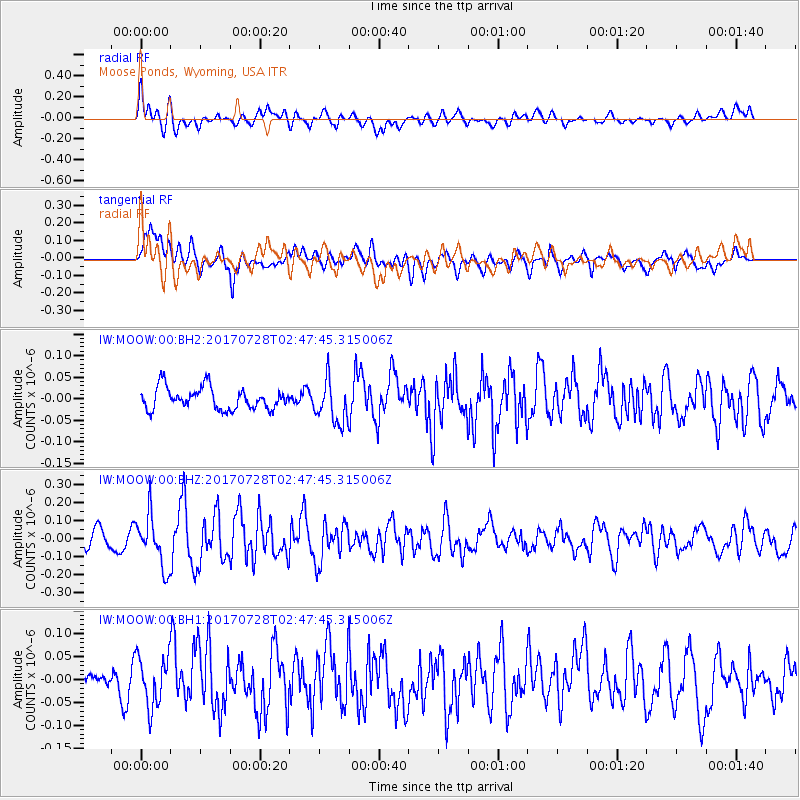
MOOW Moose Ponds, Wyoming, USA - Earthquake Result Viewer
*The percent match for this event was below the threshold and hence no stack was calculated.
| Earthquake location: |
Komandorskiye Ostrova Region |
| Earthquake latitude/longitude: |
54.3/169.3 |
| Earthquake time(UTC): |
2017/07/28 (209) 02:39:16 GMT |
| Earthquake Depth: |
10 km |
| Earthquake Magnitude: |
5.5 mb |
| Earthquake Catalog/Contributor: |
NEIC PDE/us |
|
| Network: |
IW Intermountain West |
| Station: |
MOOW Moose Ponds, Wyoming, USA |
| Lat/Lon: |
43.75 N/110.74 W |
| Elevation: |
2128 m |
|
| Distance: |
50.8 deg |
| Az: |
67.107 deg |
| Baz: |
311.883 deg |
| Ray Param: |
$rayparam |
*The percent match for this event was below the threshold and hence was not used in the summary stack. |
|
| Radial Match: |
69.22894 % |
| Radial Bump: |
400 |
| Transverse Match: |
69.91592 % |
| Transverse Bump: |
400 |
| SOD ConfigId: |
2140511 |
| Insert Time: |
2017-08-10 18:34:14.266 +0000 |
| GWidth: |
2.5 |
| Max Bumps: |
400 |
| Tol: |
0.001 |
|
Signal To Noise
| Channel | StoN | STA | LTA |
| IW:MOOW:00:BHZ:20170728T02:47:45.315006Z | 2.9188464 | 1.428335E-7 | 4.8934915E-8 |
| IW:MOOW:00:BH1:20170728T02:47:45.315006Z | 1.9670999 | 5.4158114E-8 | 2.7531959E-8 |
| IW:MOOW:00:BH2:20170728T02:47:45.315006Z | 1.9626871 | 4.9443397E-8 | 2.5191685E-8 |
| Arrivals |
| Ps | |
| PpPs | |
| PsPs/PpSs | |


