
Y64 Y64 - Earthquake Result Viewer
| ||||||||||||||||||
| ||||||||||||||||||
| ||||||||||||||||||
|
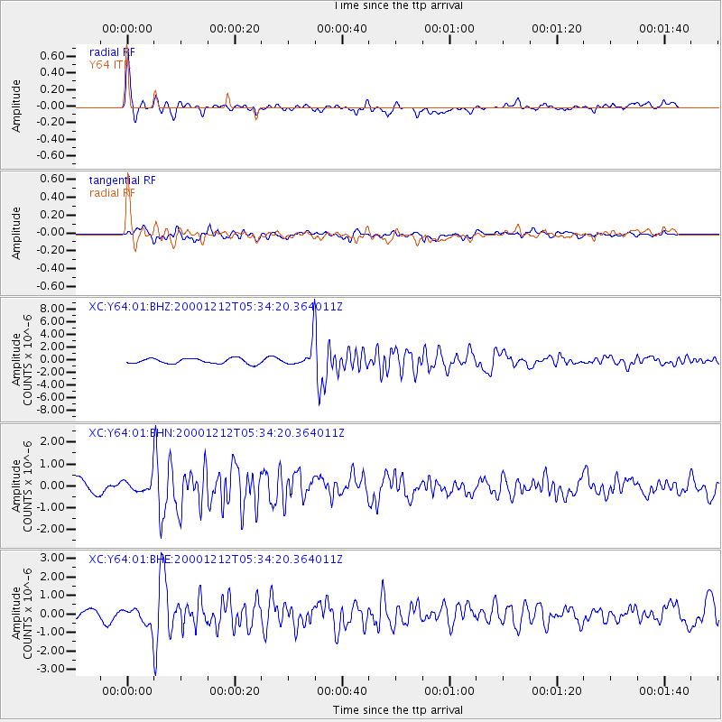
Signal To Noise
| Channel | StoN | STA | LTA |
| XC:Y64:01:BHN:20001212T05:34:20.364011Z | 1.152459 | 3.6501183E-7 | 3.1672434E-7 |
| XC:Y64:01:BHE:20001212T05:34:20.364011Z | 1.8742443 | 5.579101E-7 | 2.97672E-7 |
| XC:Y64:01:BHZ:20001212T05:34:20.364011Z | 4.488032 | 1.8513105E-6 | 4.124994E-7 |
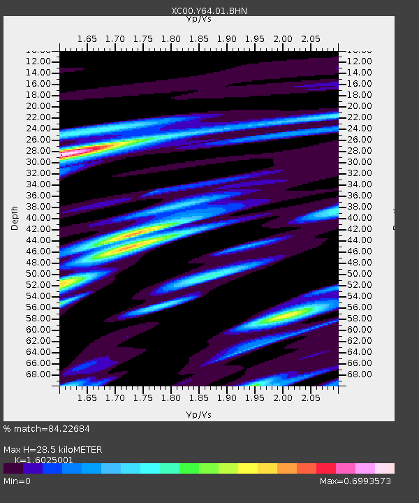
| Arrivals | |
| Ps | 3.0 SECOND |
| PpPs | 11 SECOND |
| PsPs/PpSs | 14 SECOND |

