Y64 Y64 - Earthquake Result Viewer
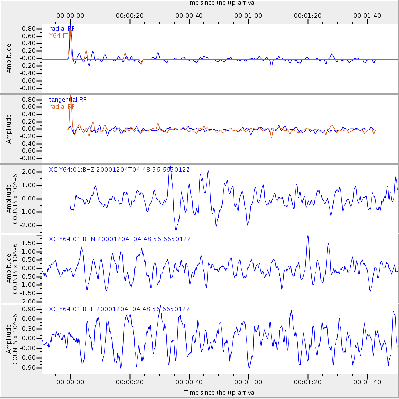
Earthquake location: Near Coast Of Chiapas, Mexico
Earthquake latitude/longitude: 14.9/-93.9
Earthquake time(UTC): 2000/12/04 (339) 04:43:09 GMT
Earthquake Depth: 33 km
Earthquake Magnitude: 5.6 MB, 5.7 MS, 6.0 MW, 5.9 MW
Earthquake Catalog/Contributor: WHDF/NEIC
Network: XC Yellowstone Intermountain Seismic Array
Station: Y64 Y64
Lat/Lon: 44.11 N/107.47 W
Elevation: 1415 m
Distance: 31.3 deg
Az: 341.088 deg
Baz: 154.213 deg
Ray Param: 0.079066195
Estimated Moho Depth: 16.75 km
Estimated Crust Vp/Vs: 2.03
Assumed Crust Vp: 6.178 km/s
Estimated Crust Vs: 3.043 km/s
Estimated Crust Poisson's Ratio: 0.34
Radial Match: 83.188934 %
Radial Bump: 330
Transverse Match: 67.69872 %
Transverse Bump: 400
SOD ConfigId: 16820
Insert Time: 2010-02-26 15:03:39.640 +0000
GWidth: 2.5
Max Bumps: 400
Tol: 0.001

Signal To Noise

ChannelStoNSTALTA
XC:Y64:01:BHN:20001204T04:48:56.665012Z1.80130345.2192615E-72.8974915E-7
XC:Y64:01:BHE:20001204T04:48:56.665012Z1.19062753.2456535E-72.7260026E-7
XC:Y64:01:BHZ:20001204T04:48:56.665012Z2.53096911.0110191E-63.9945928E-7
Arrivals
Ps3.0 SECOND
PpPs7.7 SECOND
PsPs/PpSs11 SECOND