Y64 Y64 - Earthquake Result Viewer
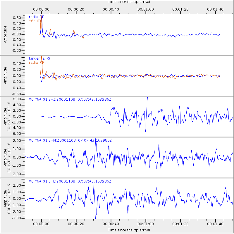
Earthquake location: Panama-Colombia Border Region
Earthquake latitude/longitude: 7.0/-77.8
Earthquake time(UTC): 2000/11/08 (313) 06:59:58 GMT
Earthquake Depth: 17 km
Earthquake Magnitude: 6.0 MB, 6.4 MS, 6.5 MW, 6.2 ML
Earthquake Catalog/Contributor: WHDF/NEIC
Network: XC Yellowstone Intermountain Seismic Array
Station: Y64 Y64
Lat/Lon: 44.11 N/107.47 W
Elevation: 1415 m
Distance: 45.1 deg
Az: 329.797 deg
Baz: 136.122 deg
Ray Param: 0.07148378
Estimated Moho Depth: 16.0 km
Estimated Crust Vp/Vs: 2.10
Assumed Crust Vp: 6.178 km/s
Estimated Crust Vs: 2.946 km/s
Estimated Crust Poisson's Ratio: 0.35
Radial Match: 90.12356 %
Radial Bump: 400
Transverse Match: 78.598114 %
Transverse Bump: 400
SOD ConfigId: 16820
Insert Time: 2010-02-26 15:03:41.945 +0000
GWidth: 2.5
Max Bumps: 400
Tol: 0.001

Signal To Noise

ChannelStoNSTALTA
XC:Y64:01:BHN:20001108T07:07:43.163986Z1.19357992.3666993E-71.9828578E-7
XC:Y64:01:BHE:20001108T07:07:43.163986Z1.16449451.9299463E-71.6573254E-7
XC:Y64:01:BHZ:20001108T07:07:43.163986Z3.32883985.094733E-71.5304832E-7
Arrivals
Ps3.0 SECOND
PpPs7.6 SECOND
PsPs/PpSs11 SECOND