You are here: Home > Network List > US - United States National Seismic Network Stations List
> Station DGMT Dagmar, Montana, USA > Earthquake Result Viewer
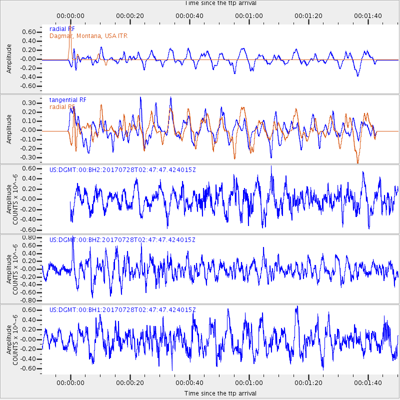
DGMT Dagmar, Montana, USA - Earthquake Result Viewer
*The percent match for this event was below the threshold and hence no stack was calculated.
| Earthquake location: |
Komandorskiye Ostrova Region |
| Earthquake latitude/longitude: |
54.3/169.3 |
| Earthquake time(UTC): |
2017/07/28 (209) 02:39:16 GMT |
| Earthquake Depth: |
10 km |
| Earthquake Magnitude: |
5.5 mb |
| Earthquake Catalog/Contributor: |
NEIC PDE/us |
|
| Network: |
US United States National Seismic Network |
| Station: |
DGMT Dagmar, Montana, USA |
| Lat/Lon: |
48.47 N/104.20 W |
| Elevation: |
0.0 m |
|
| Distance: |
51.1 deg |
| Az: |
58.663 deg |
| Baz: |
311.264 deg |
| Ray Param: |
$rayparam |
*The percent match for this event was below the threshold and hence was not used in the summary stack. |
|
| Radial Match: |
58.66772 % |
| Radial Bump: |
400 |
| Transverse Match: |
59.22655 % |
| Transverse Bump: |
400 |
| SOD ConfigId: |
2140511 |
| Insert Time: |
2017-08-10 18:35:50.921 +0000 |
| GWidth: |
2.5 |
| Max Bumps: |
400 |
| Tol: |
0.001 |
|
Signal To Noise
| Channel | StoN | STA | LTA |
| US:DGMT:00:BHZ:20170728T02:47:47.424015Z | 2.589443 | 2.9191688E-7 | 1.1273346E-7 |
| US:DGMT:00:BH1:20170728T02:47:47.424015Z | 1.1504146 | 1.4476437E-7 | 1.2583669E-7 |
| US:DGMT:00:BH2:20170728T02:47:47.424015Z | 1.2473563 | 2.2311477E-7 | 1.7887012E-7 |
| Arrivals |
| Ps | |
| PpPs | |
| PsPs/PpSs | |


