
Y64 Y64 - Earthquake Result Viewer
| ||||||||||||||||||
| ||||||||||||||||||
| ||||||||||||||||||
|
Signal To Noise
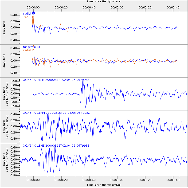
| Channel | StoN | STA | LTA |
| XC:Y64:01:BHN:20000818T02:04:06.067998Z | 1.6056376 | 1.2986102E-7 | 8.0878166E-8 |
| XC:Y64:01:BHE:20000818T02:04:06.067998Z | 1.5651671 | 1.17004966E-7 | 7.4755576E-8 |
| XC:Y64:01:BHZ:20000818T02:04:06.067998Z | 4.5550814 | 3.4521554E-7 | 7.578691E-8 |
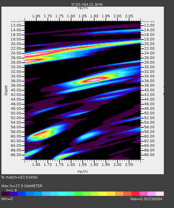
| Arrivals | |
| Ps | 2.7 SECOND |
| PpPs | 11 SECOND |
| PsPs/PpSs | 14 SECOND |

