You are here: Home > Network List > US - United States National Seismic Network Stations List
> Station MSO Missoula, Montana, USA > Earthquake Result Viewer
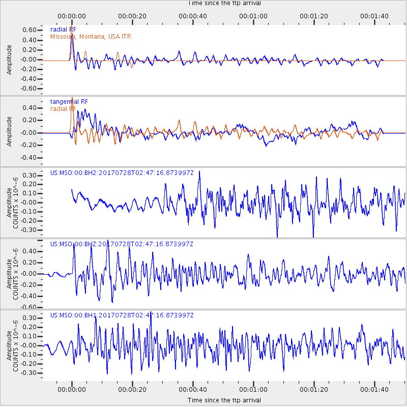
MSO Missoula, Montana, USA - Earthquake Result Viewer
*The percent match for this event was below the threshold and hence no stack was calculated.
| Earthquake location: |
Komandorskiye Ostrova Region |
| Earthquake latitude/longitude: |
54.3/169.3 |
| Earthquake time(UTC): |
2017/07/28 (209) 02:39:16 GMT |
| Earthquake Depth: |
10 km |
| Earthquake Magnitude: |
5.5 mb |
| Earthquake Catalog/Contributor: |
NEIC PDE/us |
|
| Network: |
US United States National Seismic Network |
| Station: |
MSO Missoula, Montana, USA |
| Lat/Lon: |
46.83 N/113.94 W |
| Elevation: |
1264 m |
|
| Distance: |
47.1 deg |
| Az: |
65.932 deg |
| Baz: |
308.846 deg |
| Ray Param: |
$rayparam |
*The percent match for this event was below the threshold and hence was not used in the summary stack. |
|
| Radial Match: |
75.129105 % |
| Radial Bump: |
400 |
| Transverse Match: |
50.59386 % |
| Transverse Bump: |
400 |
| SOD ConfigId: |
2140511 |
| Insert Time: |
2017-08-10 18:36:24.811 +0000 |
| GWidth: |
2.5 |
| Max Bumps: |
400 |
| Tol: |
0.001 |
|
Signal To Noise
| Channel | StoN | STA | LTA |
| US:MSO:00:BHZ:20170728T02:47:16.873997Z | 4.1673174 | 1.9650062E-7 | 4.7152785E-8 |
| US:MSO:00:BH1:20170728T02:47:16.873997Z | 1.4287541 | 9.244878E-8 | 6.470587E-8 |
| US:MSO:00:BH2:20170728T02:47:16.873997Z | 1.612773 | 8.712727E-8 | 5.402327E-8 |
| Arrivals |
| Ps | |
| PpPs | |
| PsPs/PpSs | |


