You are here: Home > Network List > CI - Caltech Regional Seismic Network Stations List
> Station MPM Manuel Prospect Mine, California, USA > Earthquake Result Viewer
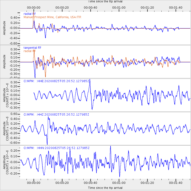
MPM Manuel Prospect Mine, California, USA - Earthquake Result Viewer
*The percent match for this event was below the threshold and hence no stack was calculated.
| Earthquake location: |
Peru-Ecuador Border Region |
| Earthquake latitude/longitude: |
-4.0/-80.8 |
| Earthquake time(UTC): |
2020/08/25 (238) 05:18:12 GMT |
| Earthquake Depth: |
33 km |
| Earthquake Magnitude: |
5.5 Mww |
| Earthquake Catalog/Contributor: |
NEIC PDE/us |
|
| Network: |
CI Caltech Regional Seismic Network |
| Station: |
MPM Manuel Prospect Mine, California, USA |
| Lat/Lon: |
36.06 N/117.49 W |
| Elevation: |
185 m |
|
| Distance: |
52.6 deg |
| Az: |
322.474 deg |
| Baz: |
131.419 deg |
| Ray Param: |
$rayparam |
*The percent match for this event was below the threshold and hence was not used in the summary stack. |
|
| Radial Match: |
58.349785 % |
| Radial Bump: |
400 |
| Transverse Match: |
58.150723 % |
| Transverse Bump: |
400 |
| SOD ConfigId: |
21709731 |
| Insert Time: |
2020-09-08 05:26:13.606 +0000 |
| GWidth: |
2.5 |
| Max Bumps: |
400 |
| Tol: |
0.001 |
|
Signal To Noise
| Channel | StoN | STA | LTA |
| CI:MPM: :HHZ:20200825T05:26:52.127985Z | 2.0889256 | 1.4979283E-7 | 7.170807E-8 |
| CI:MPM: :HHN:20200825T05:26:52.127985Z | 1.3571585 | 9.404535E-8 | 6.929577E-8 |
| CI:MPM: :HHE:20200825T05:26:52.127985Z | 1.6082202 | 9.370181E-8 | 5.8264288E-8 |
| Arrivals |
| Ps | |
| PpPs | |
| PsPs/PpSs | |


