
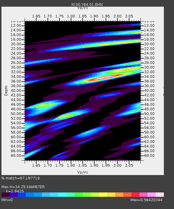
Y64 Y64 - Earthquake Result Viewer
| ||||||||||||||||||
| ||||||||||||||||||
| ||||||||||||||||||
|
Signal To Noise
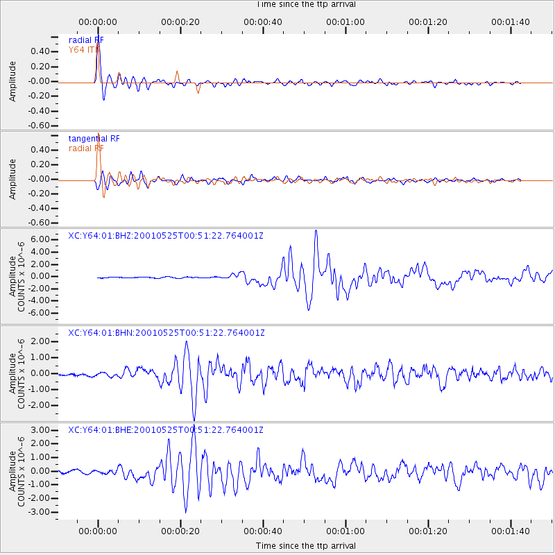
| Channel | StoN | STA | LTA |
| XC:Y64:01:BHN:20010525T00:51:22.764001Z | 1.322628 | 1.1057225E-7 | 8.360041E-8 |
| XC:Y64:01:BHE:20010525T00:51:22.764001Z | 1.2343168 | 1.2638813E-7 | 1.0239521E-7 |
| XC:Y64:01:BHZ:20010525T00:51:22.764001Z | 5.4086795 | 4.1824845E-7 | 7.732912E-8 |
| Arrivals | |
| Ps | 5.4 SECOND |
| PpPs | 16 SECOND |
| PsPs/PpSs | 21 SECOND |

