You are here: Home > Network List > TA - USArray Transportable Network (new EarthScope stations) Stations List
> Station I30M Mount Dempster, Yukon, CAN > Earthquake Result Viewer
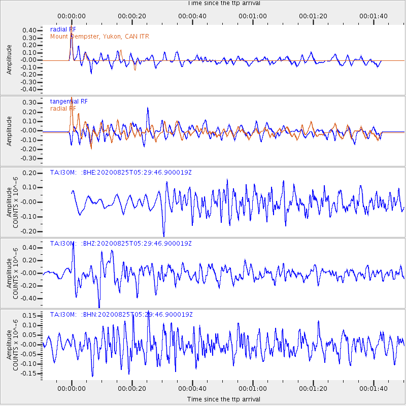
I30M Mount Dempster, Yukon, CAN - Earthquake Result Viewer
*The percent match for this event was below the threshold and hence no stack was calculated.
| Earthquake location: |
Peru-Ecuador Border Region |
| Earthquake latitude/longitude: |
-4.0/-80.8 |
| Earthquake time(UTC): |
2020/08/25 (238) 05:18:12 GMT |
| Earthquake Depth: |
33 km |
| Earthquake Magnitude: |
5.5 Mww |
| Earthquake Catalog/Contributor: |
NEIC PDE/us |
|
| Network: |
TA USArray Transportable Network (new EarthScope stations) |
| Station: |
I30M Mount Dempster, Yukon, CAN |
| Lat/Lon: |
65.22 N/136.38 W |
| Elevation: |
1399 m |
|
| Distance: |
80.0 deg |
| Az: |
339.333 deg |
| Baz: |
123.338 deg |
| Ray Param: |
$rayparam |
*The percent match for this event was below the threshold and hence was not used in the summary stack. |
|
| Radial Match: |
68.17723 % |
| Radial Bump: |
400 |
| Transverse Match: |
70.49852 % |
| Transverse Bump: |
400 |
| SOD ConfigId: |
21709731 |
| Insert Time: |
2020-09-08 05:42:28.425 +0000 |
| GWidth: |
2.5 |
| Max Bumps: |
400 |
| Tol: |
0.001 |
|
Signal To Noise
| Channel | StoN | STA | LTA |
| TA:I30M: :BHZ:20200825T05:29:46.900019Z | 6.4387336 | 2.036556E-7 | 3.162976E-8 |
| TA:I30M: :BHN:20200825T05:29:46.900019Z | 1.0176374 | 3.7326775E-8 | 3.667984E-8 |
| TA:I30M: :BHE:20200825T05:29:46.900019Z | 2.565949 | 9.443717E-8 | 3.6803993E-8 |
| Arrivals |
| Ps | |
| PpPs | |
| PsPs/PpSs | |


