You are here: Home > Network List > TX - Texas Seismological Network Stations List
> Station WTFS Witchita Falls > Earthquake Result Viewer
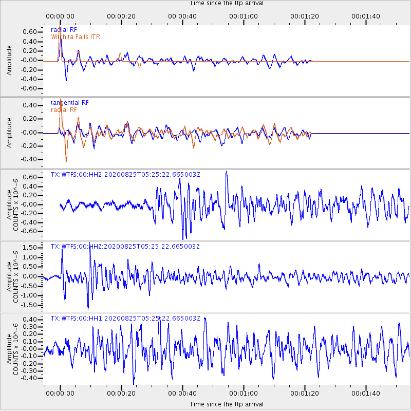
WTFS Witchita Falls - Earthquake Result Viewer
*The percent match for this event was below the threshold and hence no stack was calculated.
| Earthquake location: |
Peru-Ecuador Border Region |
| Earthquake latitude/longitude: |
-4.0/-80.8 |
| Earthquake time(UTC): |
2020/08/25 (238) 05:18:12 GMT |
| Earthquake Depth: |
33 km |
| Earthquake Magnitude: |
5.5 Mww |
| Earthquake Catalog/Contributor: |
NEIC PDE/us |
|
| Network: |
TX Texas Seismological Network |
| Station: |
WTFS Witchita Falls |
| Lat/Lon: |
33.77 N/98.46 W |
| Elevation: |
277 m |
|
| Distance: |
41.1 deg |
| Az: |
337.429 deg |
| Baz: |
152.636 deg |
| Ray Param: |
$rayparam |
*The percent match for this event was below the threshold and hence was not used in the summary stack. |
|
| Radial Match: |
73.193985 % |
| Radial Bump: |
299 |
| Transverse Match: |
62.982502 % |
| Transverse Bump: |
338 |
| SOD ConfigId: |
21709731 |
| Insert Time: |
2020-09-08 05:45:03.992 +0000 |
| GWidth: |
2.5 |
| Max Bumps: |
400 |
| Tol: |
0.001 |
|
Signal To Noise
| Channel | StoN | STA | LTA |
| TX:WTFS:00:HHZ:20200825T05:25:22.665003Z | 6.3149257 | 4.7223583E-7 | 7.47809E-8 |
| TX:WTFS:00:HH1:20200825T05:25:22.665003Z | 1.4294099 | 9.820116E-8 | 6.870049E-8 |
| TX:WTFS:00:HH2:20200825T05:25:22.665003Z | 3.9375358 | 2.211058E-7 | 5.6153343E-8 |
| Arrivals |
| Ps | |
| PpPs | |
| PsPs/PpSs | |


