You are here: Home > Network List > US - United States National Seismic Network Stations List
> Station HAWA Hanford, Washington, USA > Earthquake Result Viewer
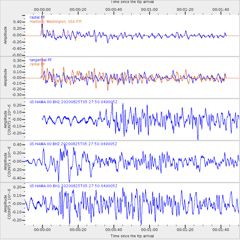
HAWA Hanford, Washington, USA - Earthquake Result Viewer
*The percent match for this event was below the threshold and hence no stack was calculated.
| Earthquake location: |
Peru-Ecuador Border Region |
| Earthquake latitude/longitude: |
-4.0/-80.8 |
| Earthquake time(UTC): |
2020/08/25 (238) 05:18:12 GMT |
| Earthquake Depth: |
33 km |
| Earthquake Magnitude: |
5.5 Mww |
| Earthquake Catalog/Contributor: |
NEIC PDE/us |
|
| Network: |
US United States National Seismic Network |
| Station: |
HAWA Hanford, Washington, USA |
| Lat/Lon: |
46.39 N/119.53 W |
| Elevation: |
364 m |
|
| Distance: |
60.8 deg |
| Az: |
330.263 deg |
| Baz: |
134.366 deg |
| Ray Param: |
$rayparam |
*The percent match for this event was below the threshold and hence was not used in the summary stack. |
|
| Radial Match: |
66.86159 % |
| Radial Bump: |
400 |
| Transverse Match: |
64.1033 % |
| Transverse Bump: |
400 |
| SOD ConfigId: |
21709731 |
| Insert Time: |
2020-09-08 05:46:01.646 +0000 |
| GWidth: |
2.5 |
| Max Bumps: |
400 |
| Tol: |
0.001 |
|
Signal To Noise
| Channel | StoN | STA | LTA |
| US:HAWA:00:BHZ:20200825T05:27:50.049005Z | 3.6585038 | 1.5303404E-7 | 4.182968E-8 |
| US:HAWA:00:BH1:20200825T05:27:50.049005Z | 1.4057064 | 5.6460546E-8 | 4.0165247E-8 |
| US:HAWA:00:BH2:20200825T05:27:50.049005Z | 1.3328325 | 4.5317076E-8 | 3.400058E-8 |
| Arrivals |
| Ps | |
| PpPs | |
| PsPs/PpSs | |


