You are here: Home > Network List > TA - USArray Transportable Network (new EarthScope stations) Stations List
> Station G21K Allakaket, AK, USA > Earthquake Result Viewer
G21K Allakaket, AK, USA - Earthquake Result Viewer

| Earthquake location: |
New Britain Region, P.N.G. |
| Earthquake latitude/longitude: |
-5.5/151.8 |
| Earthquake time(UTC): |
2020/08/25 (238) 19:02:59 GMT |
| Earthquake Depth: |
23 km |
| Earthquake Magnitude: |
5.7 Mww |
| Earthquake Catalog/Contributor: |
NEIC PDE/us |
|
| Network: |
TA USArray Transportable Network (new EarthScope stations) |
| Station: |
G21K Allakaket, AK, USA |
| Lat/Lon: |
66.52 N/153.51 W |
| Elevation: |
446 m |
|
| Distance: |
81.8 deg |
| Az: |
19.291 deg |
| Baz: |
235.143 deg |
| Ray Param: |
0.047327593 |
| Estimated Moho Depth: |
19.25 km |
| Estimated Crust Vp/Vs: |
1.85 |
| Assumed Crust Vp: |
6.455 km/s |
| Estimated Crust Vs: |
3.485 km/s |
| Estimated Crust Poisson's Ratio: |
0.29 |
|
| Radial Match: |
88.298836 % |
| Radial Bump: |
396 |
| Transverse Match: |
82.53112 % |
| Transverse Bump: |
400 |
| SOD ConfigId: |
21709731 |
| Insert Time: |
2020-09-08 19:19:09.558 +0000 |
| GWidth: |
2.5 |
| Max Bumps: |
400 |
| Tol: |
0.001 |
|
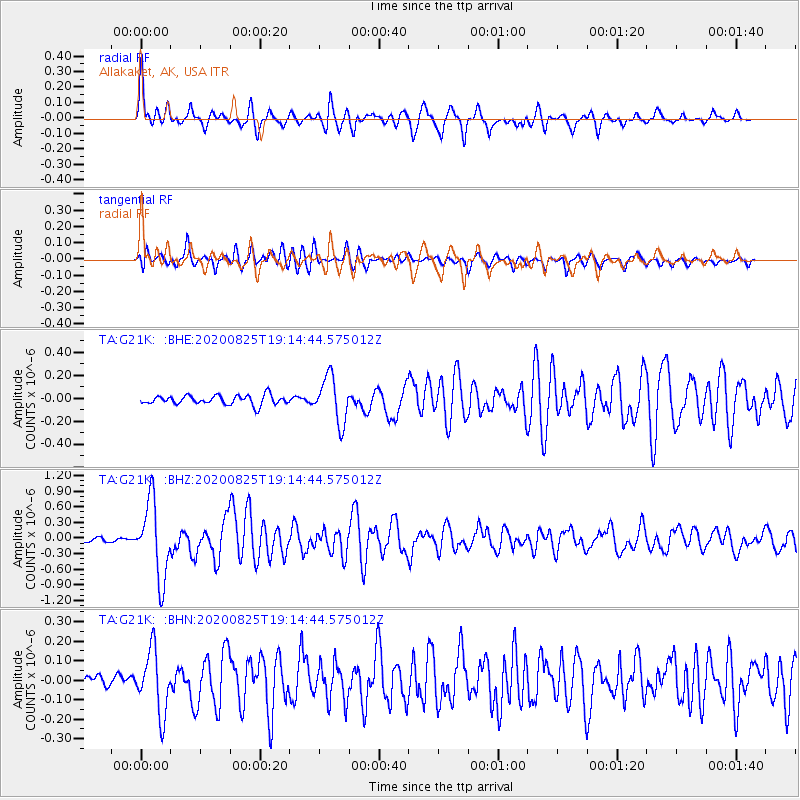
Signal To Noise
| Channel | StoN | STA | LTA |
| TA:G21K: :BHZ:20200825T19:14:44.575012Z | 17.43607 | 7.314869E-7 | 4.195251E-8 |
| TA:G21K: :BHN:20200825T19:14:44.575012Z | 6.0185714 | 1.599459E-7 | 2.6575393E-8 |
| TA:G21K: :BHE:20200825T19:14:44.575012Z | 4.844413 | 1.9659606E-7 | 4.0582023E-8 |
| Arrivals |
| Ps | 2.6 SECOND |
| PpPs | 8.3 SECOND |
| PsPs/PpSs | 11 SECOND |


