You are here: Home > Network List > AV - Alaska Volcano Observatory Stations List
> Station PLBL Mt. Peulik Volcano, Alaska > Earthquake Result Viewer
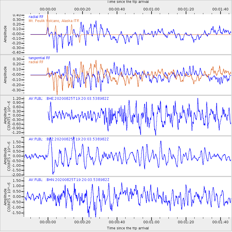
PLBL Mt. Peulik Volcano, Alaska - Earthquake Result Viewer
*The percent match for this event was below the threshold and hence no stack was calculated.
| Earthquake location: |
New Britain Region, P.N.G. |
| Earthquake latitude/longitude: |
-5.5/151.8 |
| Earthquake time(UTC): |
2020/08/25 (238) 19:08:53 GMT |
| Earthquake Depth: |
24 km |
| Earthquake Magnitude: |
6.1 mww |
| Earthquake Catalog/Contributor: |
NEIC PDE/us |
|
| Network: |
AV Alaska Volcano Observatory |
| Station: |
PLBL Mt. Peulik Volcano, Alaska |
| Lat/Lon: |
57.70 N/156.82 W |
| Elevation: |
461 m |
|
| Distance: |
75.3 deg |
| Az: |
25.687 deg |
| Baz: |
233.478 deg |
| Ray Param: |
$rayparam |
*The percent match for this event was below the threshold and hence was not used in the summary stack. |
|
| Radial Match: |
73.260704 % |
| Radial Bump: |
400 |
| Transverse Match: |
60.57471 % |
| Transverse Bump: |
400 |
| SOD ConfigId: |
21709731 |
| Insert Time: |
2020-09-08 19:39:00.646 +0000 |
| GWidth: |
2.5 |
| Max Bumps: |
400 |
| Tol: |
0.001 |
|
Signal To Noise
| Channel | StoN | STA | LTA |
| AV:PLBL: :BHZ:20200825T19:20:03.538982Z | 7.813382 | 1.2010045E-6 | 1.5371121E-7 |
| AV:PLBL: :BHN:20200825T19:20:03.538982Z | 1.3443267 | 4.3148097E-7 | 3.2096438E-7 |
| AV:PLBL: :BHE:20200825T19:20:03.538982Z | 1.8392632 | 4.0870626E-7 | 2.2221195E-7 |
| Arrivals |
| Ps | |
| PpPs | |
| PsPs/PpSs | |


