You are here: Home > Network List > IU - Global Seismograph Network (GSN - IRIS/USGS) Stations List
> Station PMG Port Moresby, New Guinea > Earthquake Result Viewer
PMG Port Moresby, New Guinea - Earthquake Result Viewer
*The percent match for this event was below the threshold and hence no stack was calculated.
| Earthquake location: |
Kuril Islands |
| Earthquake latitude/longitude: |
46.2/151.0 |
| Earthquake time(UTC): |
2017/07/30 (211) 21:00:49 GMT |
| Earthquake Depth: |
87 km |
| Earthquake Magnitude: |
5.7 mb |
| Earthquake Catalog/Contributor: |
NEIC PDE/us |
|
| Network: |
IU Global Seismograph Network (GSN - IRIS/USGS) |
| Station: |
PMG Port Moresby, New Guinea |
| Lat/Lon: |
9.40 S/147.16 E |
| Elevation: |
90 m |
|
| Distance: |
55.5 deg |
| Az: |
184.545 deg |
| Baz: |
3.197 deg |
| Ray Param: |
$rayparam |
*The percent match for this event was below the threshold and hence was not used in the summary stack. |
|
| Radial Match: |
63.851875 % |
| Radial Bump: |
400 |
| Transverse Match: |
50.46449 % |
| Transverse Bump: |
400 |
| SOD ConfigId: |
2140511 |
| Insert Time: |
2017-08-13 12:57:42.419 +0000 |
| GWidth: |
2.5 |
| Max Bumps: |
400 |
| Tol: |
0.001 |
|
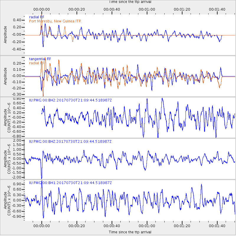
Signal To Noise
| Channel | StoN | STA | LTA |
| IU:PMG:00:BHZ:20170730T21:09:44.518987Z | 3.291952 | 7.171715E-7 | 2.17856E-7 |
| IU:PMG:00:BH1:20170730T21:09:44.518987Z | 2.0764909 | 4.6752143E-7 | 2.2514976E-7 |
| IU:PMG:00:BH2:20170730T21:09:44.518987Z | 1.1044526 | 1.9882823E-7 | 1.8002424E-7 |
| Arrivals |
| Ps | |
| PpPs | |
| PsPs/PpSs | |


