You are here: Home > Network List > IW - Intermountain West Stations List
> Station DLMT Dillon, Montana, USA > Earthquake Result Viewer
DLMT Dillon, Montana, USA - Earthquake Result Viewer
*The percent match for this event was below the threshold and hence no stack was calculated.
| Earthquake location: |
Kuril Islands |
| Earthquake latitude/longitude: |
46.2/151.0 |
| Earthquake time(UTC): |
2017/07/30 (211) 21:00:49 GMT |
| Earthquake Depth: |
87 km |
| Earthquake Magnitude: |
5.7 mb |
| Earthquake Catalog/Contributor: |
NEIC PDE/us |
|
| Network: |
IW Intermountain West |
| Station: |
DLMT Dillon, Montana, USA |
| Lat/Lon: |
45.36 N/112.60 W |
| Elevation: |
1569 m |
|
| Distance: |
62.9 deg |
| Az: |
51.89 deg |
| Baz: |
309.192 deg |
| Ray Param: |
$rayparam |
*The percent match for this event was below the threshold and hence was not used in the summary stack. |
|
| Radial Match: |
63.160908 % |
| Radial Bump: |
400 |
| Transverse Match: |
52.153904 % |
| Transverse Bump: |
367 |
| SOD ConfigId: |
2140511 |
| Insert Time: |
2017-08-13 12:58:04.835 +0000 |
| GWidth: |
2.5 |
| Max Bumps: |
400 |
| Tol: |
0.001 |
|
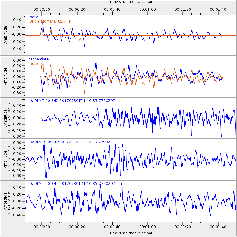
Signal To Noise
| Channel | StoN | STA | LTA |
| IW:DLMT:00:BHZ:20170730T21:10:35.775029Z | 6.2093315 | 3.578244E-7 | 5.762688E-8 |
| IW:DLMT:00:BH1:20170730T21:10:35.775029Z | 0.96257544 | 1.4557534E-7 | 1.5123526E-7 |
| IW:DLMT:00:BH2:20170730T21:10:35.775029Z | 1.5462135 | 1.6414785E-7 | 1.0616118E-7 |
| Arrivals |
| Ps | |
| PpPs | |
| PsPs/PpSs | |


