You are here: Home > Network List > IU - Global Seismograph Network (GSN - IRIS/USGS) Stations List
> Station JOHN Johnston Island, USA > Earthquake Result Viewer
JOHN Johnston Island, USA - Earthquake Result Viewer
*The percent match for this event was below the threshold and hence no stack was calculated.
| Earthquake location: |
New Britain Region, P.N.G. |
| Earthquake latitude/longitude: |
-5.5/151.8 |
| Earthquake time(UTC): |
2020/08/25 (238) 19:08:53 GMT |
| Earthquake Depth: |
24 km |
| Earthquake Magnitude: |
6.1 mww |
| Earthquake Catalog/Contributor: |
NEIC PDE/us |
|
| Network: |
IU Global Seismograph Network (GSN - IRIS/USGS) |
| Station: |
JOHN Johnston Island, USA |
| Lat/Lon: |
16.73 N/169.53 W |
| Elevation: |
2.0 m |
|
| Distance: |
44.1 deg |
| Az: |
59.242 deg |
| Baz: |
243.223 deg |
| Ray Param: |
$rayparam |
*The percent match for this event was below the threshold and hence was not used in the summary stack. |
|
| Radial Match: |
65.043564 % |
| Radial Bump: |
400 |
| Transverse Match: |
49.204075 % |
| Transverse Bump: |
400 |
| SOD ConfigId: |
21709731 |
| Insert Time: |
2020-09-08 19:45:15.456 +0000 |
| GWidth: |
2.5 |
| Max Bumps: |
400 |
| Tol: |
0.001 |
|
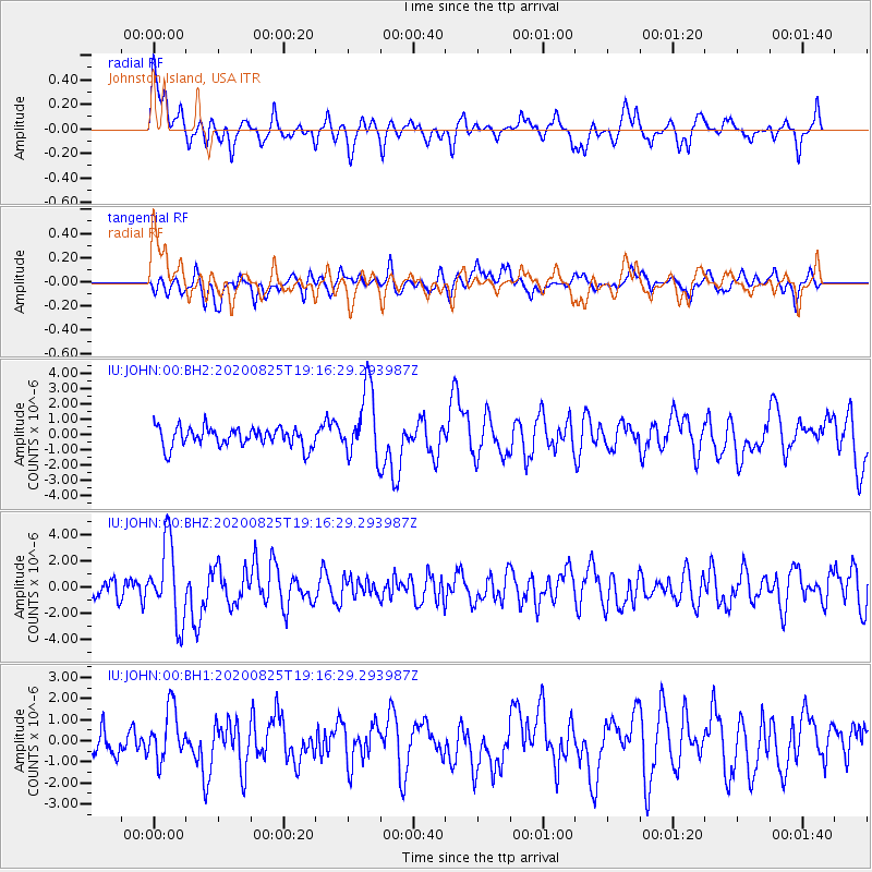
Signal To Noise
| Channel | StoN | STA | LTA |
| IU:JOHN:00:BHZ:20200825T19:16:29.293987Z | 3.4831033 | 3.0065976E-6 | 8.6319505E-7 |
| IU:JOHN:00:BH1:20200825T19:16:29.293987Z | 2.1984103 | 1.233721E-6 | 5.611878E-7 |
| IU:JOHN:00:BH2:20200825T19:16:29.293987Z | 3.6224256 | 2.2857141E-6 | 6.3099E-7 |
| Arrivals |
| Ps | |
| PpPs | |
| PsPs/PpSs | |


