You are here: Home > Network List > US - United States National Seismic Network Stations List
> Station MSO Missoula, Montana, USA > Earthquake Result Viewer
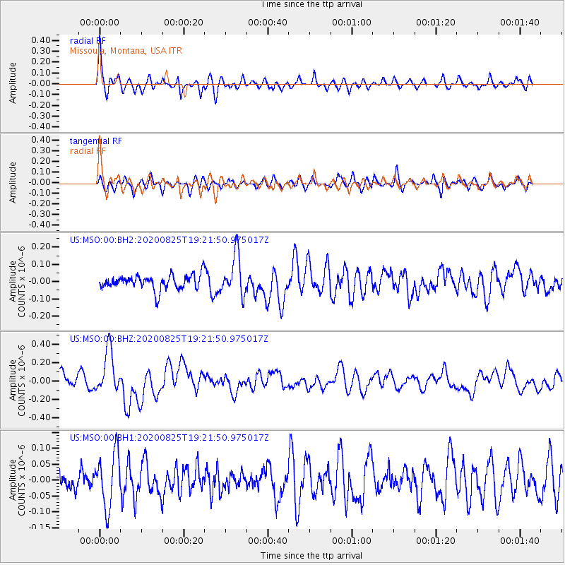
MSO Missoula, Montana, USA - Earthquake Result Viewer
*The percent match for this event was below the threshold and hence no stack was calculated.
| Earthquake location: |
New Britain Region, P.N.G. |
| Earthquake latitude/longitude: |
-5.5/151.8 |
| Earthquake time(UTC): |
2020/08/25 (238) 19:08:53 GMT |
| Earthquake Depth: |
24 km |
| Earthquake Magnitude: |
6.1 mww |
| Earthquake Catalog/Contributor: |
NEIC PDE/us |
|
| Network: |
US United States National Seismic Network |
| Station: |
MSO Missoula, Montana, USA |
| Lat/Lon: |
46.83 N/113.94 W |
| Elevation: |
1264 m |
|
| Distance: |
96.9 deg |
| Az: |
43.606 deg |
| Baz: |
269.306 deg |
| Ray Param: |
$rayparam |
*The percent match for this event was below the threshold and hence was not used in the summary stack. |
|
| Radial Match: |
66.30313 % |
| Radial Bump: |
400 |
| Transverse Match: |
53.334984 % |
| Transverse Bump: |
400 |
| SOD ConfigId: |
21709731 |
| Insert Time: |
2020-09-08 19:52:52.925 +0000 |
| GWidth: |
2.5 |
| Max Bumps: |
400 |
| Tol: |
0.001 |
|
Signal To Noise
| Channel | StoN | STA | LTA |
| US:MSO:00:BHZ:20200825T19:21:50.975017Z | 2.6622107 | 2.38734E-7 | 8.967509E-8 |
| US:MSO:00:BH1:20200825T19:21:50.975017Z | 2.7425528 | 8.692203E-8 | 3.169384E-8 |
| US:MSO:00:BH2:20200825T19:21:50.975017Z | 2.9163473 | 1.2150213E-7 | 4.1662435E-8 |
| Arrivals |
| Ps | |
| PpPs | |
| PsPs/PpSs | |


