You are here: Home > Network List > UU - University of Utah Regional Network Stations List
> Station KNB Kanab, UT, USA > Earthquake Result Viewer
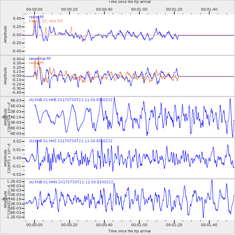
KNB Kanab, UT, USA - Earthquake Result Viewer
*The percent match for this event was below the threshold and hence no stack was calculated.
| Earthquake location: |
Kuril Islands |
| Earthquake latitude/longitude: |
46.2/151.0 |
| Earthquake time(UTC): |
2017/07/30 (211) 21:00:49 GMT |
| Earthquake Depth: |
87 km |
| Earthquake Magnitude: |
5.7 mb |
| Earthquake Catalog/Contributor: |
NEIC PDE/us |
|
| Network: |
UU University of Utah Regional Network |
| Station: |
KNB Kanab, UT, USA |
| Lat/Lon: |
37.02 N/112.82 W |
| Elevation: |
1715 m |
|
| Distance: |
68.2 deg |
| Az: |
58.966 deg |
| Baz: |
311.977 deg |
| Ray Param: |
$rayparam |
*The percent match for this event was below the threshold and hence was not used in the summary stack. |
|
| Radial Match: |
80.45208 % |
| Radial Bump: |
400 |
| Transverse Match: |
67.79847 % |
| Transverse Bump: |
400 |
| SOD ConfigId: |
2140511 |
| Insert Time: |
2017-08-13 13:03:03.962 +0000 |
| GWidth: |
2.5 |
| Max Bumps: |
400 |
| Tol: |
0.001 |
|
Signal To Noise
| Channel | StoN | STA | LTA |
| UU:KNB:01:HHZ:20170730T21:11:09.830022Z | 3.0493927 | 7.540592E-9 | 2.4728175E-9 |
| UU:KNB:01:HHN:20170730T21:11:09.830022Z | 1.0816851 | 3.4779706E-9 | 3.2153264E-9 |
| UU:KNB:01:HHE:20170730T21:11:09.830022Z | 1.152599 | 4.0787205E-9 | 3.5387158E-9 |
| Arrivals |
| Ps | |
| PpPs | |
| PsPs/PpSs | |


