You are here: Home > Network List > WY - Yellowstone Wyoming Seismic Network Stations List
> Station YPP Pitchstone Plateau, YNP, WY, USA > Earthquake Result Viewer
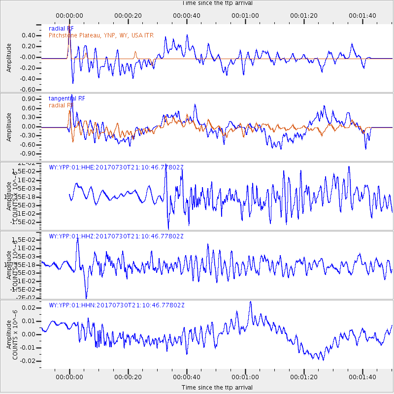
YPP Pitchstone Plateau, YNP, WY, USA - Earthquake Result Viewer
*The percent match for this event was below the threshold and hence no stack was calculated.
| Earthquake location: |
Kuril Islands |
| Earthquake latitude/longitude: |
46.2/151.0 |
| Earthquake time(UTC): |
2017/07/30 (211) 21:00:49 GMT |
| Earthquake Depth: |
87 km |
| Earthquake Magnitude: |
5.7 mb |
| Earthquake Catalog/Contributor: |
NEIC PDE/us |
|
| Network: |
WY Yellowstone Wyoming Seismic Network |
| Station: |
YPP Pitchstone Plateau, YNP, WY, USA |
| Lat/Lon: |
44.27 N/110.80 W |
| Elevation: |
2707 m |
|
| Distance: |
64.6 deg |
| Az: |
51.914 deg |
| Baz: |
310.461 deg |
| Ray Param: |
$rayparam |
*The percent match for this event was below the threshold and hence was not used in the summary stack. |
|
| Radial Match: |
29.49443 % |
| Radial Bump: |
400 |
| Transverse Match: |
32.24373 % |
| Transverse Bump: |
400 |
| SOD ConfigId: |
2140511 |
| Insert Time: |
2017-08-13 13:04:31.935 +0000 |
| GWidth: |
2.5 |
| Max Bumps: |
400 |
| Tol: |
0.001 |
|
Signal To Noise
| Channel | StoN | STA | LTA |
| WY:YPP:01:HHZ:20170730T21:10:46.77802Z | 4.100966 | 5.797404E-9 | 1.413668E-9 |
| WY:YPP:01:HHN:20170730T21:10:46.77802Z | 1.2265948 | 1.2120162E-8 | 9.881145E-9 |
| WY:YPP:01:HHE:20170730T21:10:46.77802Z | 3.0431337 | 8.347543E-9 | 2.7430747E-9 |
| Arrivals |
| Ps | |
| PpPs | |
| PsPs/PpSs | |


