You are here: Home > Network List > US - United States National Seismic Network Stations List
> Station LAO LASA Array, Montana, USA > Earthquake Result Viewer
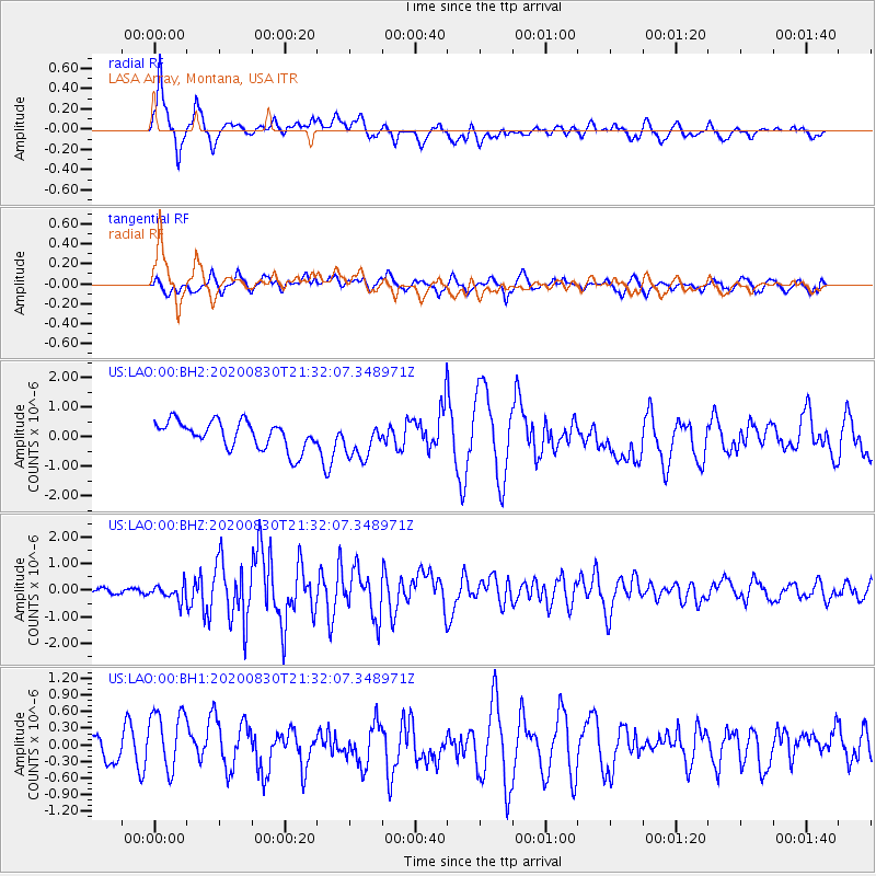
LAO LASA Array, Montana, USA - Earthquake Result Viewer
*The percent match for this event was below the threshold and hence no stack was calculated.
| Earthquake location: |
Central Mid-Atlantic Ridge |
| Earthquake latitude/longitude: |
0.9/-29.7 |
| Earthquake time(UTC): |
2020/08/30 (243) 21:20:28 GMT |
| Earthquake Depth: |
10 km |
| Earthquake Magnitude: |
6.5 mww |
| Earthquake Catalog/Contributor: |
NEIC PDE/us |
|
| Network: |
US United States National Seismic Network |
| Station: |
LAO LASA Array, Montana, USA |
| Lat/Lon: |
46.69 N/106.22 W |
| Elevation: |
902 m |
|
| Distance: |
80.1 deg |
| Az: |
317.196 deg |
| Baz: |
99.27 deg |
| Ray Param: |
$rayparam |
*The percent match for this event was below the threshold and hence was not used in the summary stack. |
|
| Radial Match: |
69.40817 % |
| Radial Bump: |
400 |
| Transverse Match: |
38.60982 % |
| Transverse Bump: |
400 |
| SOD ConfigId: |
21709731 |
| Insert Time: |
2020-09-13 21:44:28.645 +0000 |
| GWidth: |
2.5 |
| Max Bumps: |
400 |
| Tol: |
0.001 |
|
Signal To Noise
| Channel | StoN | STA | LTA |
| US:LAO:00:BHZ:20200830T21:32:07.348971Z | 2.1141367 | 2.9587912E-7 | 1.3995269E-7 |
| US:LAO:00:BH1:20200830T21:32:07.348971Z | 1.3490105 | 5.616956E-7 | 4.16376E-7 |
| US:LAO:00:BH2:20200830T21:32:07.348971Z | 1.3412006 | 6.160261E-7 | 4.5930946E-7 |
| Arrivals |
| Ps | |
| PpPs | |
| PsPs/PpSs | |


