You are here: Home > Network List > TX - Texas Seismological Network Stations List
> Station WTFS Witchita Falls > Earthquake Result Viewer
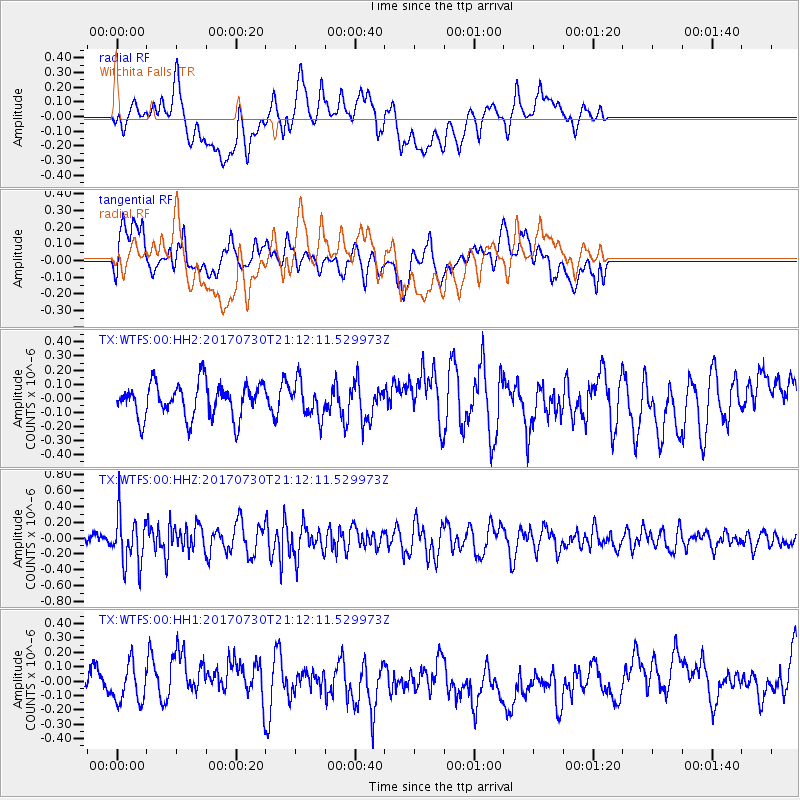
WTFS Witchita Falls - Earthquake Result Viewer
*The percent match for this event was below the threshold and hence no stack was calculated.
| Earthquake location: |
Kuril Islands |
| Earthquake latitude/longitude: |
46.2/151.0 |
| Earthquake time(UTC): |
2017/07/30 (211) 21:00:49 GMT |
| Earthquake Depth: |
87 km |
| Earthquake Magnitude: |
5.7 mb |
| Earthquake Catalog/Contributor: |
NEIC PDE/us |
|
| Network: |
TX Texas Seismological Network |
| Station: |
WTFS Witchita Falls |
| Lat/Lon: |
33.77 N/98.46 W |
| Elevation: |
277 m |
|
| Distance: |
78.8 deg |
| Az: |
52.662 deg |
| Baz: |
318.487 deg |
| Ray Param: |
$rayparam |
*The percent match for this event was below the threshold and hence was not used in the summary stack. |
|
| Radial Match: |
50.65559 % |
| Radial Bump: |
400 |
| Transverse Match: |
54.433487 % |
| Transverse Bump: |
400 |
| SOD ConfigId: |
2140511 |
| Insert Time: |
2017-08-13 13:04:54.979 +0000 |
| GWidth: |
2.5 |
| Max Bumps: |
400 |
| Tol: |
0.001 |
|
Signal To Noise
| Channel | StoN | STA | LTA |
| TX:WTFS:00:HHZ:20170730T21:12:11.529973Z | 3.4597874 | 3.1192408E-7 | 9.015701E-8 |
| TX:WTFS:00:HH1:20170730T21:12:11.529973Z | 0.8370825 | 1.2697204E-7 | 1.5168402E-7 |
| TX:WTFS:00:HH2:20170730T21:12:11.529973Z | 0.99365264 | 1.1933398E-7 | 1.2009626E-7 |
| Arrivals |
| Ps | |
| PpPs | |
| PsPs/PpSs | |


