You are here: Home > Network List > GM - US Geological Survey Networks Stations List
> Station IWM01 Jericho 2M Well Monitoring Station > Earthquake Result Viewer
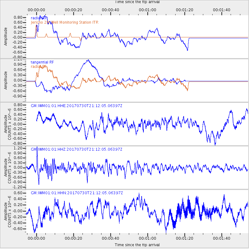
IWM01 Jericho 2M Well Monitoring Station - Earthquake Result Viewer
*The percent match for this event was below the threshold and hence no stack was calculated.
| Earthquake location: |
Kuril Islands |
| Earthquake latitude/longitude: |
46.2/151.0 |
| Earthquake time(UTC): |
2017/07/30 (211) 21:00:49 GMT |
| Earthquake Depth: |
87 km |
| Earthquake Magnitude: |
5.7 mb |
| Earthquake Catalog/Contributor: |
NEIC PDE/us |
|
| Network: |
GM US Geological Survey Networks |
| Station: |
IWM01 Jericho 2M Well Monitoring Station |
| Lat/Lon: |
36.73 N/96.53 W |
| Elevation: |
328 m |
|
| Distance: |
77.6 deg |
| Az: |
49.457 deg |
| Baz: |
318.941 deg |
| Ray Param: |
$rayparam |
*The percent match for this event was below the threshold and hence was not used in the summary stack. |
|
| Radial Match: |
42.851154 % |
| Radial Bump: |
400 |
| Transverse Match: |
48.6709 % |
| Transverse Bump: |
400 |
| SOD ConfigId: |
2140511 |
| Insert Time: |
2017-08-13 13:05:24.053 +0000 |
| GWidth: |
2.5 |
| Max Bumps: |
400 |
| Tol: |
0.001 |
|
Signal To Noise
| Channel | StoN | STA | LTA |
| GM:IWM01:01:HHZ:20170730T21:12:05.06397Z | 3.722654 | 4.296737E-7 | 1.1542132E-7 |
| GM:IWM01:01:HHN:20170730T21:12:05.06397Z | 3.9371026 | 5.282782E-7 | 1.3417943E-7 |
| GM:IWM01:01:HHE:20170730T21:12:05.06397Z | 1.323876 | 2.6619136E-7 | 2.010697E-7 |
| Arrivals |
| Ps | |
| PpPs | |
| PsPs/PpSs | |


