You are here: Home > Network List > G - GEOSCOPE Stations List
> Station PPTF Pamatai - Papeete - Tahiti island - French Polynesia, France > Earthquake Result Viewer
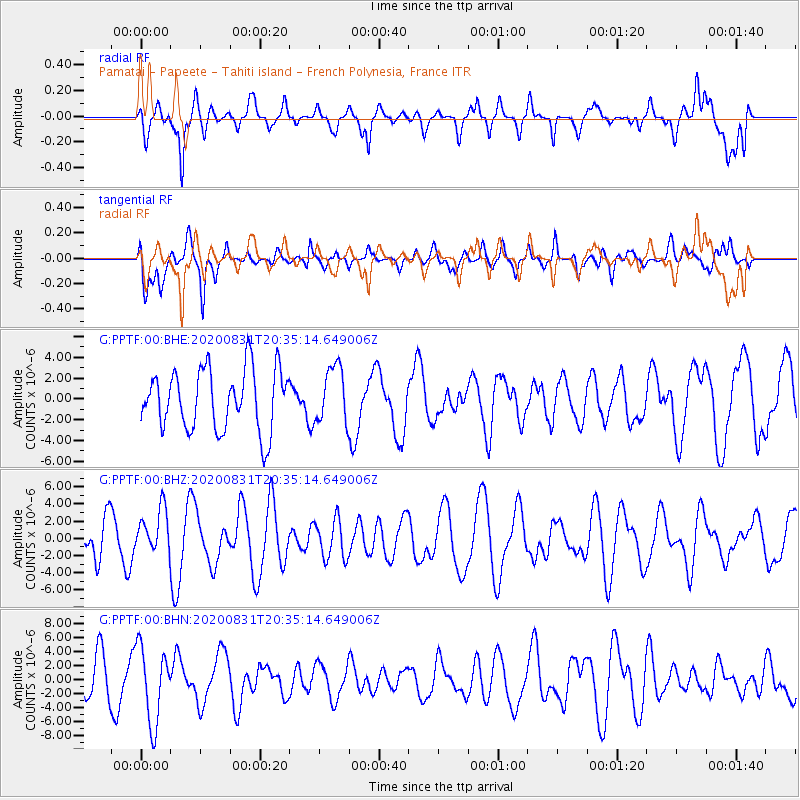
PPTF Pamatai - Papeete - Tahiti island - French Polynesia, France - Earthquake Result Viewer
*The percent match for this event was below the threshold and hence no stack was calculated.
| Earthquake location: |
Pacific-Antarctic Ridge |
| Earthquake latitude/longitude: |
-55.0/-130.1 |
| Earthquake time(UTC): |
2020/08/31 (244) 20:28:09 GMT |
| Earthquake Depth: |
10 km |
| Earthquake Magnitude: |
5.8 Mww |
| Earthquake Catalog/Contributor: |
NEIC PDE/us |
|
| Network: |
G GEOSCOPE |
| Station: |
PPTF Pamatai - Papeete - Tahiti island - French Polynesia, France |
| Lat/Lon: |
17.59 S/149.57 W |
| Elevation: |
705 m |
|
| Distance: |
40.2 deg |
| Az: |
330.475 deg |
| Baz: |
162.671 deg |
| Ray Param: |
$rayparam |
*The percent match for this event was below the threshold and hence was not used in the summary stack. |
|
| Radial Match: |
53.04359 % |
| Radial Bump: |
400 |
| Transverse Match: |
60.30807 % |
| Transverse Bump: |
400 |
| SOD ConfigId: |
21709731 |
| Insert Time: |
2020-09-14 20:44:28.626 +0000 |
| GWidth: |
2.5 |
| Max Bumps: |
400 |
| Tol: |
0.001 |
|
Signal To Noise
| Channel | StoN | STA | LTA |
| G:PPTF:00:BHZ:20200831T20:35:14.649006Z | 1.486665 | 2.5394038E-6 | 1.708121E-6 |
| G:PPTF:00:BHN:20200831T20:35:14.649006Z | 1.8379474 | 5.4530988E-6 | 2.9669502E-6 |
| G:PPTF:00:BHE:20200831T20:35:14.649006Z | 0.9366802 | 2.7315389E-6 | 2.9161915E-6 |
| Arrivals |
| Ps | |
| PpPs | |
| PsPs/PpSs | |


