You are here: Home > Network List > II - Global Seismograph Network (GSN - IRIS/IDA) Stations List
> Station PFO Pinon Flat, California, USA > Earthquake Result Viewer
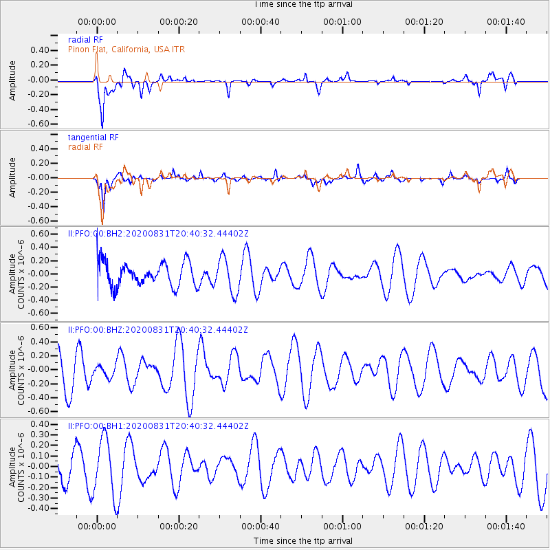
PFO Pinon Flat, California, USA - Earthquake Result Viewer
*The percent match for this event was below the threshold and hence no stack was calculated.
| Earthquake location: |
Pacific-Antarctic Ridge |
| Earthquake latitude/longitude: |
-55.0/-130.1 |
| Earthquake time(UTC): |
2020/08/31 (244) 20:28:09 GMT |
| Earthquake Depth: |
10 km |
| Earthquake Magnitude: |
5.8 Mww |
| Earthquake Catalog/Contributor: |
NEIC PDE/us |
|
| Network: |
II Global Seismograph Network (GSN - IRIS/IDA) |
| Station: |
PFO Pinon Flat, California, USA |
| Lat/Lon: |
33.61 N/116.46 W |
| Elevation: |
1280 m |
|
| Distance: |
89.0 deg |
| Az: |
11.344 deg |
| Baz: |
187.81 deg |
| Ray Param: |
$rayparam |
*The percent match for this event was below the threshold and hence was not used in the summary stack. |
|
| Radial Match: |
74.35849 % |
| Radial Bump: |
400 |
| Transverse Match: |
52.130165 % |
| Transverse Bump: |
316 |
| SOD ConfigId: |
21709731 |
| Insert Time: |
2020-09-14 20:45:18.898 +0000 |
| GWidth: |
2.5 |
| Max Bumps: |
400 |
| Tol: |
0.001 |
|
Signal To Noise
| Channel | StoN | STA | LTA |
| II:PFO:00:BHZ:20200831T20:40:32.44402Z | 0.37465227 | 8.317473E-8 | 2.2200516E-7 |
| II:PFO:00:BH1:20200831T20:40:32.44402Z | 1.8765576 | 2.7479174E-7 | 1.4643395E-7 |
| II:PFO:00:BH2:20200831T20:40:32.44402Z | 1.4603134 | 2.683583E-7 | 1.8376758E-7 |
| Arrivals |
| Ps | |
| PpPs | |
| PsPs/PpSs | |


