You are here: Home > Network List > GS - US Geological Survey Networks Stations List
> Station MT01 Lincoln Ranger Stn, Helena Natl Forest, Montana, USA > Earthquake Result Viewer
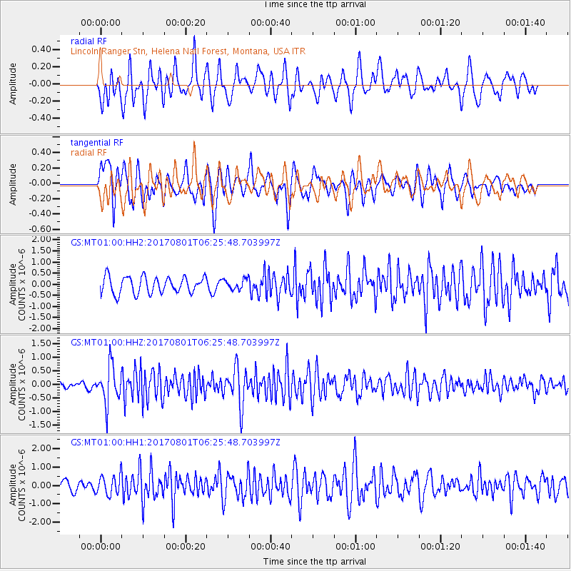
MT01 Lincoln Ranger Stn, Helena Natl Forest, Montana, USA - Earthquake Result Viewer
*The percent match for this event was below the threshold and hence no stack was calculated.
| Earthquake location: |
La Rioja Province, Argentina |
| Earthquake latitude/longitude: |
-28.6/-68.7 |
| Earthquake time(UTC): |
2017/08/01 (213) 06:13:53 GMT |
| Earthquake Depth: |
85 km |
| Earthquake Magnitude: |
5.6 Mww |
| Earthquake Catalog/Contributor: |
NEIC PDE/us |
|
| Network: |
GS US Geological Survey Networks |
| Station: |
MT01 Lincoln Ranger Stn, Helena Natl Forest, Montana, USA |
| Lat/Lon: |
46.95 N/112.66 W |
| Elevation: |
1318 m |
|
| Distance: |
85.0 deg |
| Az: |
331.493 deg |
| Baz: |
142.201 deg |
| Ray Param: |
$rayparam |
*The percent match for this event was below the threshold and hence was not used in the summary stack. |
|
| Radial Match: |
62.258057 % |
| Radial Bump: |
400 |
| Transverse Match: |
73.25698 % |
| Transverse Bump: |
400 |
| SOD ConfigId: |
2140511 |
| Insert Time: |
2017-08-14 22:09:24.459 +0000 |
| GWidth: |
2.5 |
| Max Bumps: |
400 |
| Tol: |
0.001 |
|
Signal To Noise
| Channel | StoN | STA | LTA |
| GS:MT01:00:HHZ:20170801T06:25:48.703997Z | 5.7870736 | 6.9848437E-7 | 1.2069734E-7 |
| GS:MT01:00:HH1:20170801T06:25:48.703997Z | 1.4858695 | 5.325323E-7 | 3.5839773E-7 |
| GS:MT01:00:HH2:20170801T06:25:48.703997Z | 0.617414 | 2.3195291E-7 | 3.7568455E-7 |
| Arrivals |
| Ps | |
| PpPs | |
| PsPs/PpSs | |


