You are here: Home > Network List > IW - Intermountain West Stations List
> Station MOOW Moose Ponds, Wyoming, USA > Earthquake Result Viewer
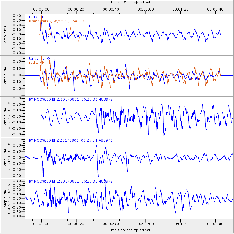
MOOW Moose Ponds, Wyoming, USA - Earthquake Result Viewer
*The percent match for this event was below the threshold and hence no stack was calculated.
| Earthquake location: |
La Rioja Province, Argentina |
| Earthquake latitude/longitude: |
-28.6/-68.7 |
| Earthquake time(UTC): |
2017/08/01 (213) 06:13:53 GMT |
| Earthquake Depth: |
85 km |
| Earthquake Magnitude: |
5.6 Mww |
| Earthquake Catalog/Contributor: |
NEIC PDE/us |
|
| Network: |
IW Intermountain West |
| Station: |
MOOW Moose Ponds, Wyoming, USA |
| Lat/Lon: |
43.75 N/110.74 W |
| Elevation: |
2128 m |
|
| Distance: |
81.6 deg |
| Az: |
330.625 deg |
| Baz: |
143.456 deg |
| Ray Param: |
$rayparam |
*The percent match for this event was below the threshold and hence was not used in the summary stack. |
|
| Radial Match: |
68.333405 % |
| Radial Bump: |
400 |
| Transverse Match: |
63.70501 % |
| Transverse Bump: |
400 |
| SOD ConfigId: |
2140511 |
| Insert Time: |
2017-08-14 22:10:28.737 +0000 |
| GWidth: |
2.5 |
| Max Bumps: |
400 |
| Tol: |
0.001 |
|
Signal To Noise
| Channel | StoN | STA | LTA |
| IW:MOOW:00:BHZ:20170801T06:25:31.48897Z | 9.750542 | 3.2240408E-7 | 3.306525E-8 |
| IW:MOOW:00:BH1:20170801T06:25:31.48897Z | 2.4600556 | 1.3204959E-7 | 5.3677486E-8 |
| IW:MOOW:00:BH2:20170801T06:25:31.48897Z | 1.6393975 | 1.18466936E-7 | 7.226249E-8 |
| Arrivals |
| Ps | |
| PpPs | |
| PsPs/PpSs | |


