You are here: Home > Network List > US - United States National Seismic Network Stations List
> Station HAWA Hanford, Washington, USA > Earthquake Result Viewer
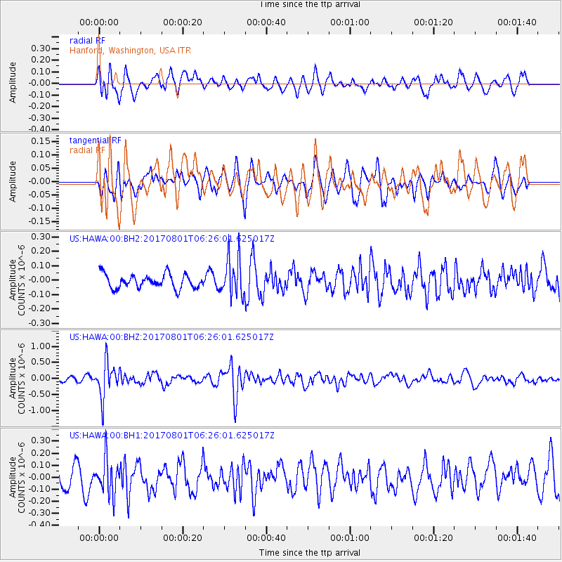
HAWA Hanford, Washington, USA - Earthquake Result Viewer
*The percent match for this event was below the threshold and hence no stack was calculated.
| Earthquake location: |
La Rioja Province, Argentina |
| Earthquake latitude/longitude: |
-28.6/-68.7 |
| Earthquake time(UTC): |
2017/08/01 (213) 06:13:53 GMT |
| Earthquake Depth: |
85 km |
| Earthquake Magnitude: |
5.6 Mww |
| Earthquake Catalog/Contributor: |
NEIC PDE/us |
|
| Network: |
US United States National Seismic Network |
| Station: |
HAWA Hanford, Washington, USA |
| Lat/Lon: |
46.39 N/119.53 W |
| Elevation: |
364 m |
|
| Distance: |
87.6 deg |
| Az: |
327.518 deg |
| Baz: |
136.956 deg |
| Ray Param: |
$rayparam |
*The percent match for this event was below the threshold and hence was not used in the summary stack. |
|
| Radial Match: |
58.82378 % |
| Radial Bump: |
400 |
| Transverse Match: |
48.42011 % |
| Transverse Bump: |
400 |
| SOD ConfigId: |
2140511 |
| Insert Time: |
2017-08-14 22:12:43.383 +0000 |
| GWidth: |
2.5 |
| Max Bumps: |
400 |
| Tol: |
0.001 |
|
Signal To Noise
| Channel | StoN | STA | LTA |
| US:HAWA:00:BHZ:20170801T06:26:01.625017Z | 4.9503007 | 5.5037015E-7 | 1.1117913E-7 |
| US:HAWA:00:BH1:20170801T06:26:01.625017Z | 1.9473623 | 1.4943237E-7 | 7.673578E-8 |
| US:HAWA:00:BH2:20170801T06:26:01.625017Z | 2.8254318 | 1.3489183E-7 | 4.7742024E-8 |
| Arrivals |
| Ps | |
| PpPs | |
| PsPs/PpSs | |


