You are here: Home > Network List > US - United States National Seismic Network Stations List
> Station MNTX Cornudas Mountains, Texas, USA > Earthquake Result Viewer
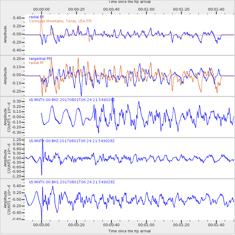
MNTX Cornudas Mountains, Texas, USA - Earthquake Result Viewer
*The percent match for this event was below the threshold and hence no stack was calculated.
| Earthquake location: |
La Rioja Province, Argentina |
| Earthquake latitude/longitude: |
-28.6/-68.7 |
| Earthquake time(UTC): |
2017/08/01 (213) 06:13:53 GMT |
| Earthquake Depth: |
85 km |
| Earthquake Magnitude: |
5.6 Mww |
| Earthquake Catalog/Contributor: |
NEIC PDE/us |
|
| Network: |
US United States National Seismic Network |
| Station: |
MNTX Cornudas Mountains, Texas, USA |
| Lat/Lon: |
31.70 N/105.38 W |
| Elevation: |
404 m |
|
| Distance: |
69.3 deg |
| Az: |
327.036 deg |
| Baz: |
145.838 deg |
| Ray Param: |
$rayparam |
*The percent match for this event was below the threshold and hence was not used in the summary stack. |
|
| Radial Match: |
59.055992 % |
| Radial Bump: |
400 |
| Transverse Match: |
61.254112 % |
| Transverse Bump: |
400 |
| SOD ConfigId: |
2140511 |
| Insert Time: |
2017-08-14 22:13:18.076 +0000 |
| GWidth: |
2.5 |
| Max Bumps: |
400 |
| Tol: |
0.001 |
|
Signal To Noise
| Channel | StoN | STA | LTA |
| US:MNTX:00:BHZ:20170801T06:24:21.549028Z | 2.8810112 | 3.8913743E-7 | 1.3506974E-7 |
| US:MNTX:00:BH1:20170801T06:24:21.549028Z | 1.5413914 | 1.9459398E-7 | 1.2624567E-7 |
| US:MNTX:00:BH2:20170801T06:24:21.549028Z | 1.2672365 | 1.4417019E-7 | 1.1376739E-7 |
| Arrivals |
| Ps | |
| PpPs | |
| PsPs/PpSs | |


