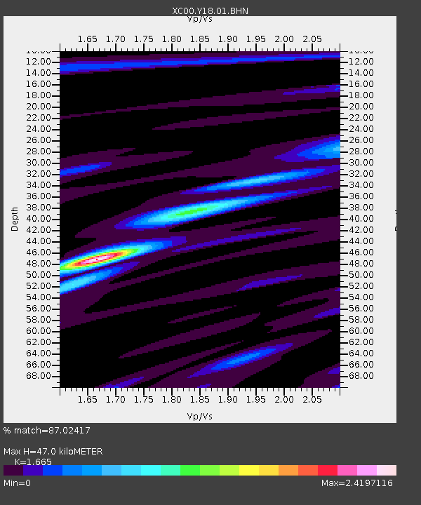
Y18 Y18 - Earthquake Result Viewer
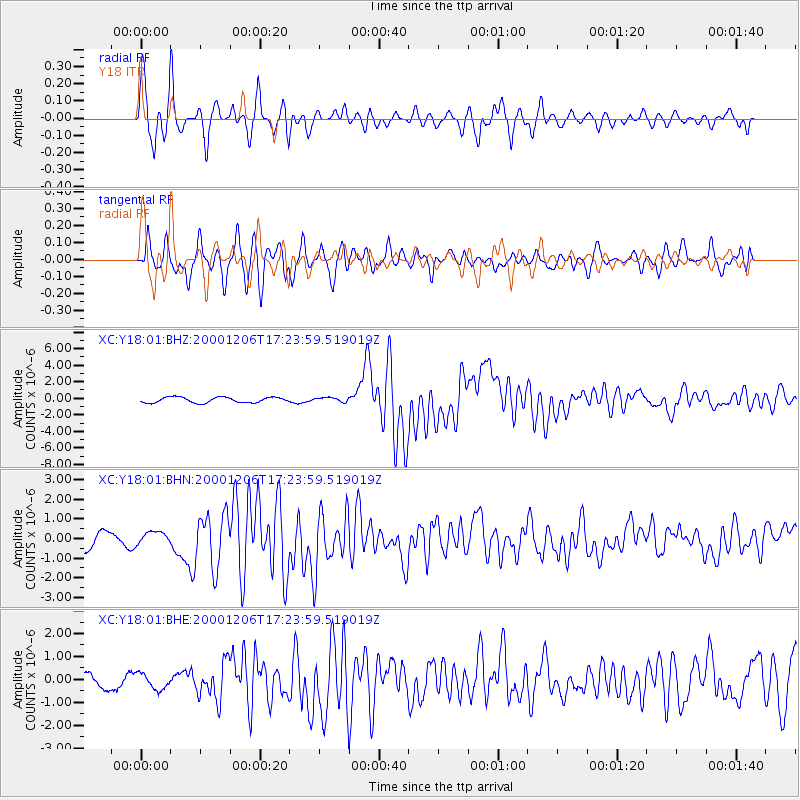
Earthquake location: Turkmenistan
Earthquake latitude/longitude: 39.6/54.8
Earthquake time(UTC): 2000/12/06 (341) 17:11:06 GMT
Earthquake Depth: 30 km
Earthquake Magnitude: 6.7 MB, 7.5 MS, 7.0 MW, 6.9 ME
Earthquake Catalog/Contributor: WHDF/NEIC
Network: XC Yellowstone Intermountain Seismic Array
Station: Y18 Y18
Lat/Lon: 43.75 N/111.03 W
Elevation: 1998 m
Distance: 96.1 deg
Az: 349.721 deg
Baz: 10.972 deg
Ray Param: 0.040599216
Estimated Moho Depth: 47.0 km
Estimated Crust Vp/Vs: 1.66
Assumed Crust Vp: 6.207 km/s
Estimated Crust Vs: 3.728 km/s
Estimated Crust Poisson's Ratio: 0.22
Radial Match: 87.02417 %
Radial Bump: 400
Transverse Match: 78.08285 %
Transverse Bump: 400
SOD ConfigId: 16820
Insert Time: 2010-02-26 15:04:56.879 +0000
GWidth: 2.5
Max Bumps: 400
Tol: 0.001

Signal To Noise

ChannelStoNSTALTA
XC:Y18:01:BHN:20001206T17:23:59.519019Z0.86625623.0413852E-73.5109537E-7
XC:Y18:01:BHE:20001206T17:23:59.519019Z1.08571553.56396E-73.282591E-7
XC:Y18:01:BHZ:20001206T17:23:59.519019Z0.81034412.6932307E-73.3235642E-7
Arrivals
Ps5.1 SECOND
PpPs20 SECOND
PsPs/PpSs25 SECOND