Y18 Y18 - Earthquake Result Viewer
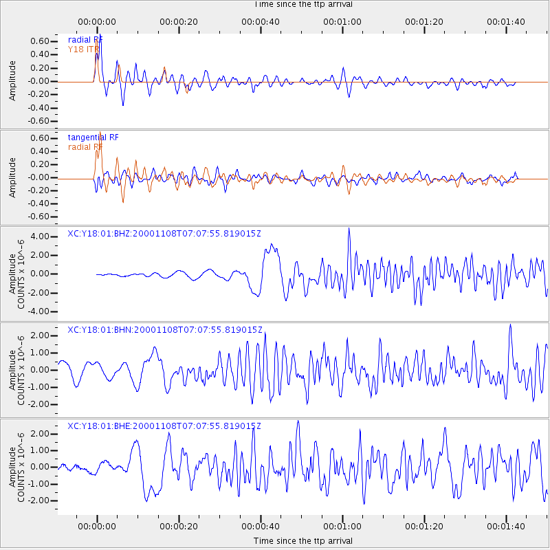
Earthquake location: Panama-Colombia Border Region
Earthquake latitude/longitude: 7.0/-77.8
Earthquake time(UTC): 2000/11/08 (313) 06:59:58 GMT
Earthquake Depth: 17 km
Earthquake Magnitude: 6.0 MB, 6.4 MS, 6.5 MW, 6.2 ML
Earthquake Catalog/Contributor: WHDF/NEIC
Network: XC Yellowstone Intermountain Seismic Array
Station: Y18 Y18
Lat/Lon: 43.75 N/111.03 W
Elevation: 1998 m
Distance: 46.7 deg
Az: 326.962 deg
Baz: 131.691 deg
Ray Param: 0.07046135
Estimated Moho Depth: 13.25 km
Estimated Crust Vp/Vs: 1.60
Assumed Crust Vp: 6.207 km/s
Estimated Crust Vs: 3.879 km/s
Estimated Crust Poisson's Ratio: 0.18
Radial Match: 87.43494 %
Radial Bump: 389
Transverse Match: 69.54375 %
Transverse Bump: 400
SOD ConfigId: 3744
Insert Time: 2010-02-26 15:05:00.122 +0000
GWidth: 2.5
Max Bumps: 400
Tol: 0.001

Signal To Noise

ChannelStoNSTALTA
XC:Y18:01:BHN:20001108T07:07:55.819015Z1.23321843.9270608E-73.1844002E-7
XC:Y18:01:BHE:20001108T07:07:55.819015Z1.38263272.8276628E-72.0451294E-7
XC:Y18:01:BHZ:20001108T07:07:55.819015Z1.56415063.540651E-72.2636253E-7
Arrivals
Ps1.4 SECOND
PpPs5.2 SECOND
PsPs/PpSs6.6 SECOND