Y18 Y18 - Earthquake Result Viewer
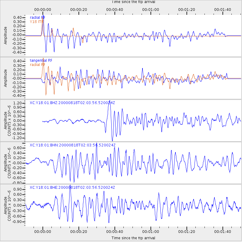
Earthquake location: Near S. Coast Of Honshu, Japan
Earthquake latitude/longitude: 34.1/139.2
Earthquake time(UTC): 2000/08/18 (231) 01:52:20 GMT
Earthquake Depth: 10 km
Earthquake Magnitude: 5.6 MB, 5.5 MS, 5.8 MW, 5.7 MW
Earthquake Catalog/Contributor: WHDF/NEIC
Network: XC Yellowstone Intermountain Seismic Array
Station: Y18 Y18
Lat/Lon: 43.75 N/111.03 W
Elevation: 1998 m
Distance: 79.6 deg
Az: 43.896 deg
Baz: 307.469 deg
Ray Param: 0.0488799
Estimated Moho Depth: 35.5 km
Estimated Crust Vp/Vs: 1.86
Assumed Crust Vp: 6.207 km/s
Estimated Crust Vs: 3.332 km/s
Estimated Crust Poisson's Ratio: 0.30
Radial Match: 80.864044 %
Radial Bump: 400
Transverse Match: 75.63424 %
Transverse Bump: 400
SOD ConfigId: 16820
Insert Time: 2010-02-26 15:05:07.833 +0000
GWidth: 2.5
Max Bumps: 400
Tol: 0.001

Signal To Noise

ChannelStoNSTALTA
XC:Y18:01:BHN:20000818T02:03:56.520024Z0.725334477.09732E-89.784893E-8
XC:Y18:01:BHE:20000818T02:03:56.520024Z0.95128821.06346356E-71.1179194E-7
XC:Y18:01:BHZ:20000818T02:03:56.520024Z1.71379031.3591247E-77.930519E-8
Arrivals
Ps5.1 SECOND
PpPs16 SECOND
PsPs/PpSs21 SECOND