
Y18 Y18 - Earthquake Result Viewer
| ||||||||||||||||||
| ||||||||||||||||||
| ||||||||||||||||||
|
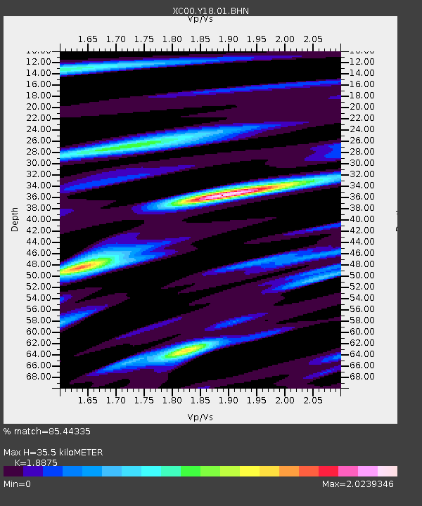
Signal To Noise
| Channel | StoN | STA | LTA |
| XC:Y18:01:BHN:20010414T23:39:09.613003Z | 1.0448452 | 1.2125237E-7 | 1.1604816E-7 |
| XC:Y18:01:BHE:20010414T23:39:09.613003Z | 1.2216496 | 1.3078747E-7 | 1.0705808E-7 |
| XC:Y18:01:BHZ:20010414T23:39:09.613003Z | 1.2891504 | 1.7622457E-7 | 1.3669823E-7 |
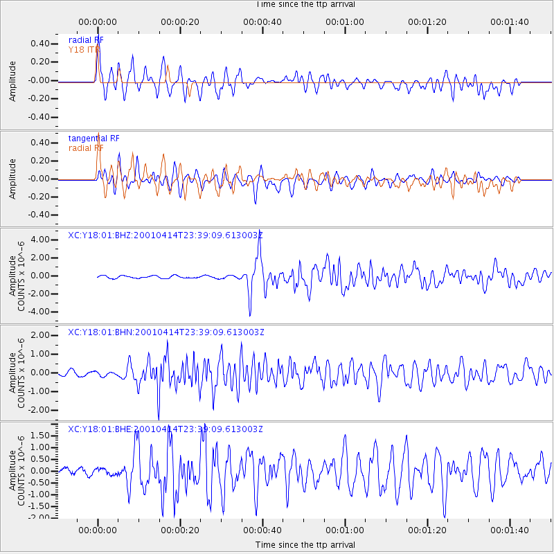
| Arrivals | |
| Ps | 5.2 SECOND |
| PpPs | 16 SECOND |
| PsPs/PpSs | 21 SECOND |

