
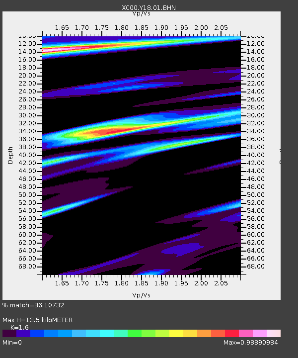
Y18 Y18 - Earthquake Result Viewer
| ||||||||||||||||||
| ||||||||||||||||||
| ||||||||||||||||||
|
Signal To Noise
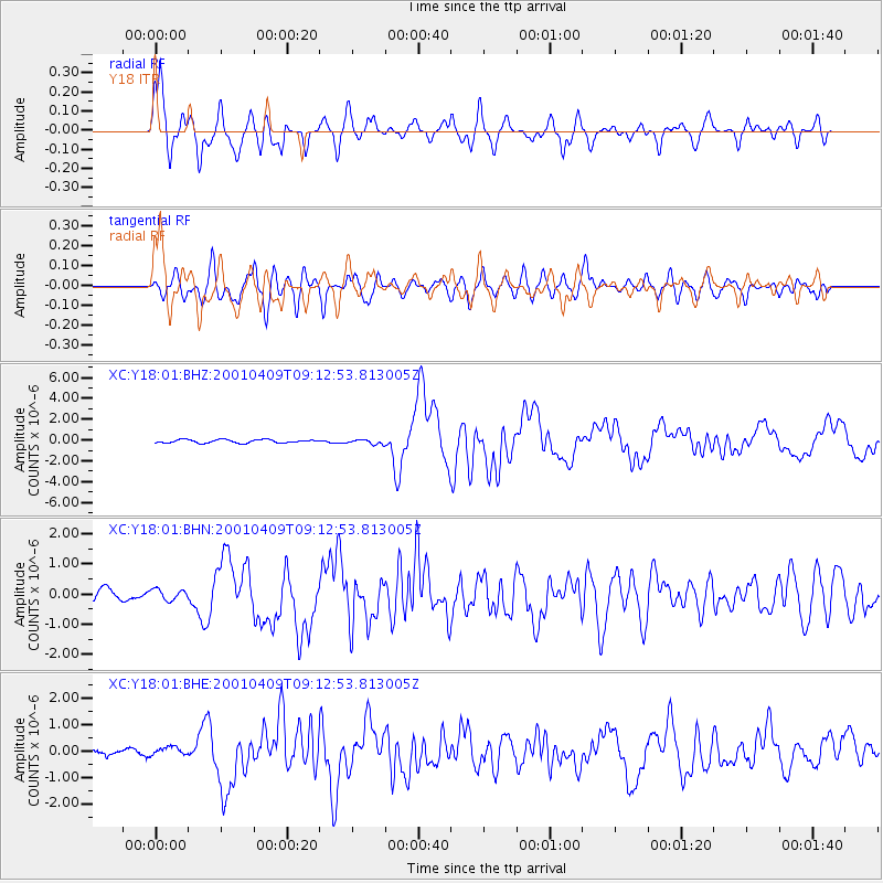
| Channel | StoN | STA | LTA |
| XC:Y18:01:BHN:20010409T09:12:53.813005Z | 0.78150624 | 1.8253989E-7 | 2.3357447E-7 |
| XC:Y18:01:BHE:20010409T09:12:53.813005Z | 1.2274082 | 1.6163304E-7 | 1.3168646E-7 |
| XC:Y18:01:BHZ:20010409T09:12:53.813005Z | 1.3294644 | 2.1491773E-7 | 1.6165738E-7 |
| Arrivals | |
| Ps | 1.3 SECOND |
| PpPs | 5.5 SECOND |
| PsPs/PpSs | 6.8 SECOND |

