You are here: Home > Network List > TA - USArray Transportable Network (new EarthScope stations) Stations List
> Station B18K Kokolik River, AK, USA > Earthquake Result Viewer
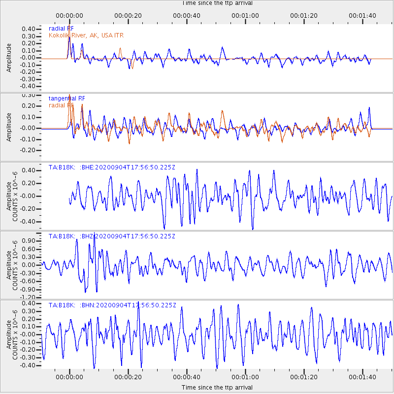
B18K Kokolik River, AK, USA - Earthquake Result Viewer
*The percent match for this event was below the threshold and hence no stack was calculated.
| Earthquake location: |
Panama-Costa Rica Border Region |
| Earthquake latitude/longitude: |
8.3/-83.0 |
| Earthquake time(UTC): |
2020/09/04 (248) 17:45:21 GMT |
| Earthquake Depth: |
8.7 km |
| Earthquake Magnitude: |
5.6 Mww |
| Earthquake Catalog/Contributor: |
NEIC PDE/us |
|
| Network: |
TA USArray Transportable Network (new EarthScope stations) |
| Station: |
B18K Kokolik River, AK, USA |
| Lat/Lon: |
69.36 N/161.80 W |
| Elevation: |
222 m |
|
| Distance: |
78.3 deg |
| Az: |
339.197 deg |
| Baz: |
97.531 deg |
| Ray Param: |
$rayparam |
*The percent match for this event was below the threshold and hence was not used in the summary stack. |
|
| Radial Match: |
59.79559 % |
| Radial Bump: |
400 |
| Transverse Match: |
46.9704 % |
| Transverse Bump: |
400 |
| SOD ConfigId: |
22732711 |
| Insert Time: |
2020-09-18 18:07:21.915 +0000 |
| GWidth: |
2.5 |
| Max Bumps: |
400 |
| Tol: |
0.001 |
|
Signal To Noise
| Channel | StoN | STA | LTA |
| TA:B18K: :BHZ:20200904T17:56:50.225Z | 2.8379588 | 4.29021E-7 | 1.5117237E-7 |
| TA:B18K: :BHN:20200904T17:56:50.225Z | 0.8091922 | 1.1328242E-7 | 1.3999446E-7 |
| TA:B18K: :BHE:20200904T17:56:50.225Z | 1.590136 | 2.1501795E-7 | 1.3521984E-7 |
| Arrivals |
| Ps | |
| PpPs | |
| PsPs/PpSs | |


