You are here: Home > Network List > US - United States National Seismic Network Stations List
> Station HAWA Hanford, Washington, USA > Earthquake Result Viewer
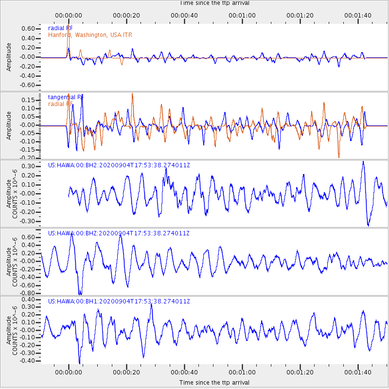
HAWA Hanford, Washington, USA - Earthquake Result Viewer
*The percent match for this event was below the threshold and hence no stack was calculated.
| Earthquake location: |
Panama-Costa Rica Border Region |
| Earthquake latitude/longitude: |
8.3/-83.0 |
| Earthquake time(UTC): |
2020/09/04 (248) 17:45:21 GMT |
| Earthquake Depth: |
8.7 km |
| Earthquake Magnitude: |
5.6 Mww |
| Earthquake Catalog/Contributor: |
NEIC PDE/us |
|
| Network: |
US United States National Seismic Network |
| Station: |
HAWA Hanford, Washington, USA |
| Lat/Lon: |
46.39 N/119.53 W |
| Elevation: |
364 m |
|
| Distance: |
49.1 deg |
| Az: |
326.975 deg |
| Baz: |
128.813 deg |
| Ray Param: |
$rayparam |
*The percent match for this event was below the threshold and hence was not used in the summary stack. |
|
| Radial Match: |
56.896694 % |
| Radial Bump: |
400 |
| Transverse Match: |
68.4992 % |
| Transverse Bump: |
400 |
| SOD ConfigId: |
22732711 |
| Insert Time: |
2020-09-18 18:11:17.723 +0000 |
| GWidth: |
2.5 |
| Max Bumps: |
400 |
| Tol: |
0.001 |
|
Signal To Noise
| Channel | StoN | STA | LTA |
| US:HAWA:00:BHZ:20200904T17:53:38.274011Z | 2.264576 | 5.0131547E-7 | 2.2137276E-7 |
| US:HAWA:00:BH1:20200904T17:53:38.274011Z | 1.8243032 | 1.6865597E-7 | 9.244954E-8 |
| US:HAWA:00:BH2:20200904T17:53:38.274011Z | 1.6151115 | 1.5898152E-7 | 9.843378E-8 |
| Arrivals |
| Ps | |
| PpPs | |
| PsPs/PpSs | |


