You are here: Home > Network List > US - United States National Seismic Network Stations List
> Station MSO Missoula, Montana, USA > Earthquake Result Viewer
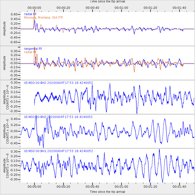
MSO Missoula, Montana, USA - Earthquake Result Viewer
*The percent match for this event was below the threshold and hence no stack was calculated.
| Earthquake location: |
Panama-Costa Rica Border Region |
| Earthquake latitude/longitude: |
8.3/-83.0 |
| Earthquake time(UTC): |
2020/09/04 (248) 17:45:21 GMT |
| Earthquake Depth: |
8.7 km |
| Earthquake Magnitude: |
5.6 Mww |
| Earthquake Catalog/Contributor: |
NEIC PDE/us |
|
| Network: |
US United States National Seismic Network |
| Station: |
MSO Missoula, Montana, USA |
| Lat/Lon: |
46.83 N/113.94 W |
| Elevation: |
1264 m |
|
| Distance: |
46.6 deg |
| Az: |
330.9 deg |
| Baz: |
135.5 deg |
| Ray Param: |
$rayparam |
*The percent match for this event was below the threshold and hence was not used in the summary stack. |
|
| Radial Match: |
56.978058 % |
| Radial Bump: |
400 |
| Transverse Match: |
59.020714 % |
| Transverse Bump: |
400 |
| SOD ConfigId: |
22732711 |
| Insert Time: |
2020-09-18 18:11:32.799 +0000 |
| GWidth: |
2.5 |
| Max Bumps: |
400 |
| Tol: |
0.001 |
|
Signal To Noise
| Channel | StoN | STA | LTA |
| US:MSO:00:BHZ:20200904T17:53:18.424005Z | 2.2646449 | 2.668834E-7 | 1.178478E-7 |
| US:MSO:00:BH1:20200904T17:53:18.424005Z | 0.83574957 | 1.0337456E-7 | 1.2369082E-7 |
| US:MSO:00:BH2:20200904T17:53:18.424005Z | 1.9865359 | 1.3225672E-7 | 6.6576554E-8 |
| Arrivals |
| Ps | |
| PpPs | |
| PsPs/PpSs | |


