You are here: Home > Network List > US - United States National Seismic Network Stations List
> Station WMOK Wichita Mountains, Oklahoma, USA > Earthquake Result Viewer
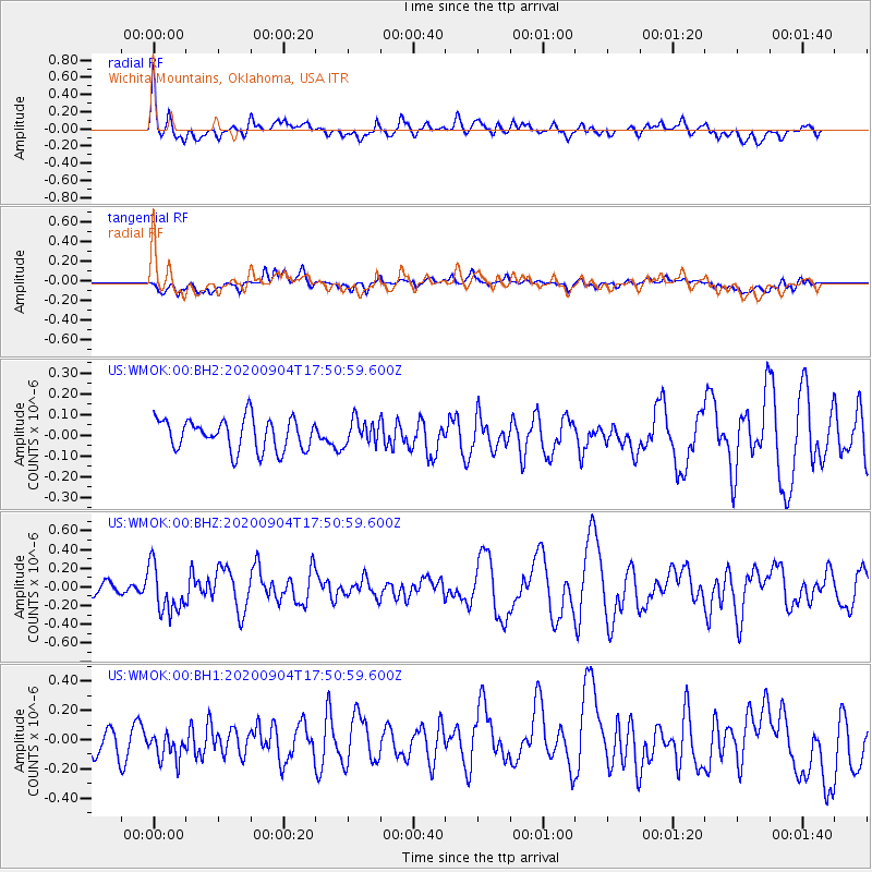
WMOK Wichita Mountains, Oklahoma, USA - Earthquake Result Viewer
*The percent match for this event was below the threshold and hence no stack was calculated.
| Earthquake location: |
Panama-Costa Rica Border Region |
| Earthquake latitude/longitude: |
8.3/-83.0 |
| Earthquake time(UTC): |
2020/09/04 (248) 17:45:21 GMT |
| Earthquake Depth: |
8.7 km |
| Earthquake Magnitude: |
5.6 Mww |
| Earthquake Catalog/Contributor: |
NEIC PDE/us |
|
| Network: |
US United States National Seismic Network |
| Station: |
WMOK Wichita Mountains, Oklahoma, USA |
| Lat/Lon: |
34.74 N/98.78 W |
| Elevation: |
486 m |
|
| Distance: |
30.0 deg |
| Az: |
333.369 deg |
| Baz: |
147.411 deg |
| Ray Param: |
$rayparam |
*The percent match for this event was below the threshold and hence was not used in the summary stack. |
|
| Radial Match: |
59.378418 % |
| Radial Bump: |
400 |
| Transverse Match: |
55.437065 % |
| Transverse Bump: |
400 |
| SOD ConfigId: |
22732711 |
| Insert Time: |
2020-09-18 18:11:42.597 +0000 |
| GWidth: |
2.5 |
| Max Bumps: |
400 |
| Tol: |
0.001 |
|
Signal To Noise
| Channel | StoN | STA | LTA |
| US:WMOK:00:BHZ:20200904T17:50:59.600Z | 2.4874706 | 2.5029965E-7 | 1.0062416E-7 |
| US:WMOK:00:BH1:20200904T17:50:59.600Z | 1.417588 | 1.2501867E-7 | 8.8191115E-8 |
| US:WMOK:00:BH2:20200904T17:50:59.600Z | 0.7921022 | 6.029503E-8 | 7.612026E-8 |
| Arrivals |
| Ps | |
| PpPs | |
| PsPs/PpSs | |


