
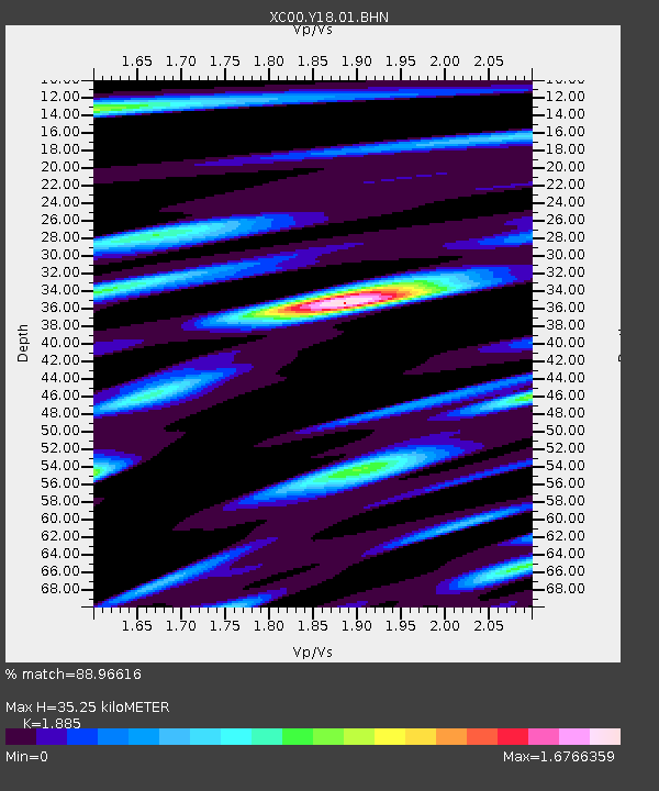
Y18 Y18 - Earthquake Result Viewer
| ||||||||||||||||||
| ||||||||||||||||||
| ||||||||||||||||||
|
Signal To Noise
| Channel | StoN | STA | LTA |
| XC:Y18:01:BHN:20010525T00:51:12.115015Z | 0.90411454 | 2.2032332E-7 | 2.436896E-7 |
| XC:Y18:01:BHE:20010525T00:51:12.115015Z | 0.79400873 | 8.7226624E-8 | 1.09856E-7 |
| XC:Y18:01:BHZ:20010525T00:51:12.115015Z | 2.9366076 | 2.1396546E-7 | 7.286144E-8 |
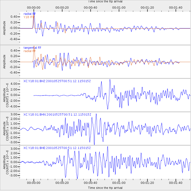
| Arrivals | |
| Ps | 5.2 SECOND |
| PpPs | 16 SECOND |
| PsPs/PpSs | 21 SECOND |

