You are here: Home > Network List > IW - Intermountain West Stations List
> Station PLID Pearl Lake, Idaho, USA > Earthquake Result Viewer
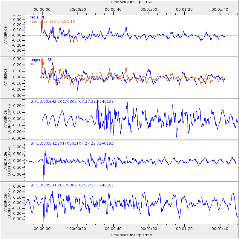
PLID Pearl Lake, Idaho, USA - Earthquake Result Viewer
*The percent match for this event was below the threshold and hence no stack was calculated.
| Earthquake location: |
Chile-Argentina Border Region |
| Earthquake latitude/longitude: |
-33.2/-70.6 |
| Earthquake time(UTC): |
2017/08/02 (214) 07:15:13 GMT |
| Earthquake Depth: |
88 km |
| Earthquake Magnitude: |
5.5 Mww |
| Earthquake Catalog/Contributor: |
NEIC PDE/us |
|
| Network: |
IW Intermountain West |
| Station: |
PLID Pearl Lake, Idaho, USA |
| Lat/Lon: |
45.09 N/116.00 W |
| Elevation: |
2164 m |
|
| Distance: |
88.1 deg |
| Az: |
329.711 deg |
| Baz: |
143.353 deg |
| Ray Param: |
$rayparam |
*The percent match for this event was below the threshold and hence was not used in the summary stack. |
|
| Radial Match: |
63.31062 % |
| Radial Bump: |
400 |
| Transverse Match: |
61.53338 % |
| Transverse Bump: |
400 |
| SOD ConfigId: |
2140511 |
| Insert Time: |
2017-08-15 23:09:52.591 +0000 |
| GWidth: |
2.5 |
| Max Bumps: |
400 |
| Tol: |
0.001 |
|
Signal To Noise
| Channel | StoN | STA | LTA |
| IW:PLID:00:BHZ:20170802T07:27:23.724019Z | 5.3206387 | 4.3509357E-7 | 8.177469E-8 |
| IW:PLID:00:BH1:20170802T07:27:23.724019Z | 1.5606006 | 1.223416E-7 | 7.8393924E-8 |
| IW:PLID:00:BH2:20170802T07:27:23.724019Z | 1.8227478 | 1.1190447E-7 | 6.139328E-8 |
| Arrivals |
| Ps | |
| PpPs | |
| PsPs/PpSs | |


