You are here: Home > Network List > US - United States National Seismic Network Stations List
> Station MSO Missoula, Montana, USA > Earthquake Result Viewer
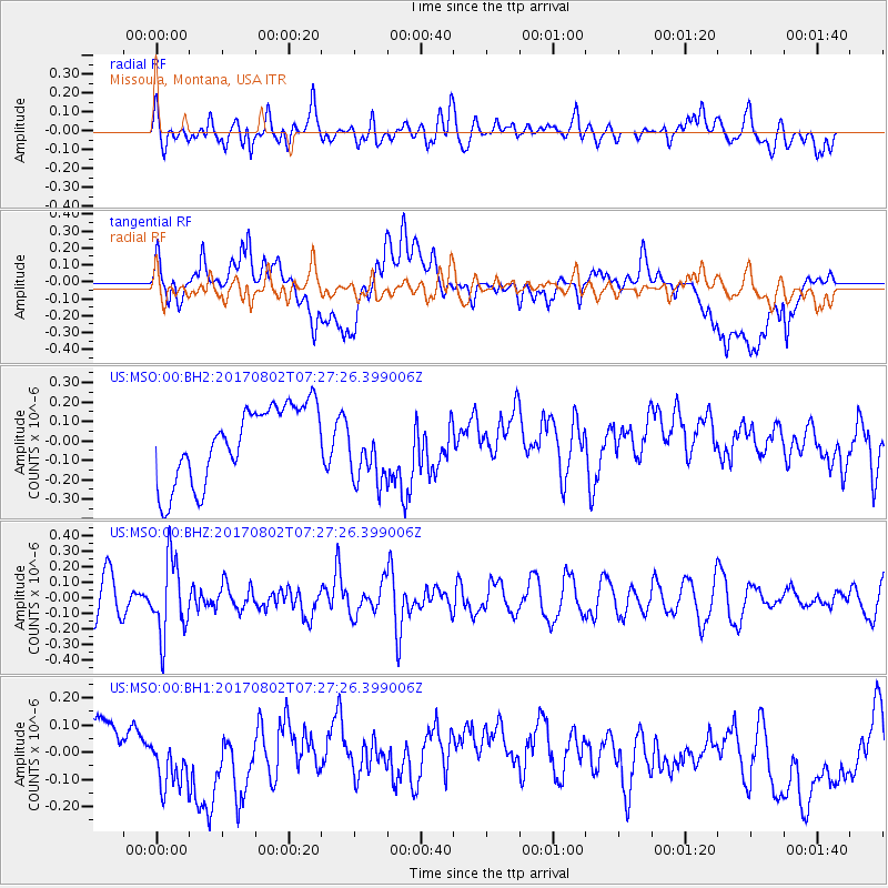
MSO Missoula, Montana, USA - Earthquake Result Viewer
*The percent match for this event was below the threshold and hence no stack was calculated.
| Earthquake location: |
Chile-Argentina Border Region |
| Earthquake latitude/longitude: |
-33.2/-70.6 |
| Earthquake time(UTC): |
2017/08/02 (214) 07:15:13 GMT |
| Earthquake Depth: |
88 km |
| Earthquake Magnitude: |
5.5 Mww |
| Earthquake Catalog/Contributor: |
NEIC PDE/us |
|
| Network: |
US United States National Seismic Network |
| Station: |
MSO Missoula, Montana, USA |
| Lat/Lon: |
46.83 N/113.94 W |
| Elevation: |
1264 m |
|
| Distance: |
88.7 deg |
| Az: |
331.897 deg |
| Baz: |
144.889 deg |
| Ray Param: |
$rayparam |
*The percent match for this event was below the threshold and hence was not used in the summary stack. |
|
| Radial Match: |
52.028942 % |
| Radial Bump: |
400 |
| Transverse Match: |
26.078318 % |
| Transverse Bump: |
400 |
| SOD ConfigId: |
2140511 |
| Insert Time: |
2017-08-15 23:11:41.931 +0000 |
| GWidth: |
2.5 |
| Max Bumps: |
400 |
| Tol: |
0.001 |
|
Signal To Noise
| Channel | StoN | STA | LTA |
| US:MSO:00:BHZ:20170802T07:27:26.399006Z | 2.0081146 | 2.3982497E-7 | 1.1942792E-7 |
| US:MSO:00:BH1:20170802T07:27:26.399006Z | 0.66098696 | 9.179709E-8 | 1.3887882E-7 |
| US:MSO:00:BH2:20170802T07:27:26.399006Z | 0.8578572 | 1.673907E-7 | 1.951265E-7 |
| Arrivals |
| Ps | |
| PpPs | |
| PsPs/PpSs | |


