You are here: Home > Network List > UU - University of Utah Regional Network Stations List
> Station FORU South Mineral Mountains, UT, USA > Earthquake Result Viewer
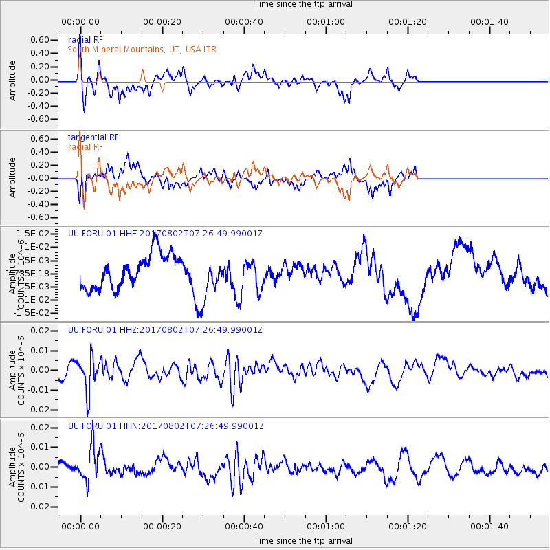
FORU South Mineral Mountains, UT, USA - Earthquake Result Viewer
*The percent match for this event was below the threshold and hence no stack was calculated.
| Earthquake location: |
Chile-Argentina Border Region |
| Earthquake latitude/longitude: |
-33.2/-70.6 |
| Earthquake time(UTC): |
2017/08/02 (214) 07:15:13 GMT |
| Earthquake Depth: |
88 km |
| Earthquake Magnitude: |
5.5 Mww |
| Earthquake Catalog/Contributor: |
NEIC PDE/us |
|
| Network: |
UU University of Utah Regional Network |
| Station: |
FORU South Mineral Mountains, UT, USA |
| Lat/Lon: |
38.46 N/112.86 W |
| Elevation: |
1840 m |
|
| Distance: |
81.4 deg |
| Az: |
327.748 deg |
| Baz: |
145.26 deg |
| Ray Param: |
$rayparam |
*The percent match for this event was below the threshold and hence was not used in the summary stack. |
|
| Radial Match: |
62.60232 % |
| Radial Bump: |
317 |
| Transverse Match: |
62.56639 % |
| Transverse Bump: |
302 |
| SOD ConfigId: |
2140511 |
| Insert Time: |
2017-08-15 23:12:15.283 +0000 |
| GWidth: |
2.5 |
| Max Bumps: |
400 |
| Tol: |
0.001 |
|
Signal To Noise
| Channel | StoN | STA | LTA |
| UU:FORU:01:HHZ:20170802T07:26:49.99001Z | 1.8109088 | 8.929707E-9 | 4.9310636E-9 |
| UU:FORU:01:HHN:20170802T07:26:49.99001Z | 1.9560257 | 8.878805E-9 | 4.539207E-9 |
| UU:FORU:01:HHE:20170802T07:26:49.99001Z | 1.4189967 | 8.831141E-9 | 6.223511E-9 |
| Arrivals |
| Ps | |
| PpPs | |
| PsPs/PpSs | |


